Access management standards are the technical and regulatory rules that govern where and how driveways, intersections, medians, and traffic signals connect to a public roadway. Three sources control most projects: the Federal Highway Administration (FHWA) sets the national framework, state departments of transportation like VDOT and FDOT write the enforceable rules, and firms like Urban Planning Pros translate those rules into a workable site plan.
Two things to do right now:
- Pull your state DOT's access management standard and your county's technical chapter (often a PDF) for the specific roadway your site touches.
- Call the permitting office or commission a feasibility check before you finalize a site layout, not after.
Pro Tip: Skipping the roadway classification check is the single most common reason access plans get bounced back for revision.
Key Takeaways
Access management standards work only when you check the roadway's official classification before designing driveway locations, medians, and turn lanes around it.
| Point | Details |
|---|---|
| Confirm classification first | Pull your roadway's functional classification before sketching access, since it sets your spacing allowance. |
| Get the primary documents | Download your state DOT standard (VDOT, FDOT, or equivalent) and county PDF chapter before designing. |
| Treat sample figures as local | Numbers like the 660-foot arterial spacing benchmark vary by jurisdiction; verify the actual figure locally. |
| Coordinate early with agencies | Loop in DOT or county engineering staff during feasibility, not after entitlement, to avoid redesign. |
| Commission a feasibility check | Urban Planning Pros reviews access classification, spacing, and permit exposure before you finalize a site plan. |
Table of Contents
- What Are Access Management Standards and Why They Matter
- What Technical Elements Do Reviewers Actually Check?
- Where Do These Rules Actually Get Written Down?
- How Does the Access Permit Process Actually Work?
- Which Reference Documents Should You Download First?
- When Should You Apply Access Standards in Feasibility Planning?
- How Urban Planning Pros Helps You De-Risk Access Approvals
- Frequently Asked Questions
- Sources
What Are Access Management Standards and Why They Matter
Access management is the coordinated planning, regulation, and design of connections between roadways and adjacent land, and the FHWA frames it as a balance between two competing needs: giving a parcel access to the road and keeping that road moving traffic safely. Every standard exists to manage that tension.
The objectives repeat across nearly every state and county document:
- Reduce conflict points that cause crashes at driveways and intersections
- Preserve corridor capacity so a road doesn't degrade faster than planned
- Keep traffic operations predictable for signal timing and queue length
- Accommodate pedestrians, cyclists, and transit, not just vehicles
That last point has shifted the field. Access management increasingly factors in multimodal demand alongside vehicle counts, which means a driveway design that only accounts for car turning movements can still fail a modern review.
What Technical Elements Do Reviewers Actually Check?
Most approvals hinge on a short list of measurable design elements, and knowing them before you sketch a site plan saves a redesign later.
- Driveway spacing. Minimum distance between connections along the same corridor, scaled to roadway speed and classification.
- Intersection spacing. Distance between a driveway and the nearest signalized or major intersection.
- Functional area. The zone around an intersection where turning, queuing, and signal operations need protection from nearby access points.
- Median openings. Where left turns are permitted, and how far apart those openings sit.
- Left-turn provisions and signal spacing. Whether a connection needs a dedicated turn lane or falls within an area planned for future signalization.
- Access point design. Sight distance, driveway width, turning radii, and internal circulation.
Access management plans built on FHWA and TRB guidance often include sample spacing tables, and one common benchmark treats 660 feet as a target minimum spacing on strategic arterials. That figure is jurisdiction-specific, not universal, so always confirm the actual number in your state DOT or county PDF before designing to it.
Use this quick checklist during plan review: confirm sight distance at every proposed connection, verify whether a left-turn lane is required, check if right-in/right-out restrictions apply, and ask whether a shared access agreement with a neighboring parcel is expected.
Pro Tip: Request the county's classification map before you draw anything. Roadway classification, not lot shape, usually determines your spacing allowance.
Where Do These Rules Actually Get Written Down?
Standards live in a handful of predictable document types: state DOT technical manuals and standards pages, administrative code sections, and county-level technical chapters, often published as standalone PDFs.
A few concrete places to start:
- VDOT's access management standards page covers connections on Virginia's county and local roadway system.
- FDOT's access management guidance lays out rules and permit contacts for driveways and connections on Florida's state highway system.
- Randall County's Access Management Standards PDF is a working example of how a county codifies spacing and driveway rules in enforceable language.
- Smaller municipalities, including Murray City, Utah, publish tighter single-document standards that make good quick references for permit steps.
Most state DOTs also maintain GIS layers, often distributed as KMZ or KML files, that map functional classification and access category by segment. Download those before you commit to a site layout. They frequently answer the spacing question faster than the text of the ordinance itself.
How Does the Access Permit Process Actually Work?
A typical connection permit moves through a fairly consistent sequence, though the agency, fee schedule, and review timeline all vary by jurisdiction.
- Pre-application meeting with the DOT district office or county engineer
- Formal application submission with site plans and traffic data
- Technical review against spacing, sight distance, and classification standards
- Agency comments and requested revisions
- Permit issuance
- Inspection and as-built certification once construction is complete
As a planning heuristic, expect pre-application meetings to take several weeks to schedule, and full technical review to run multiple weeks depending on how many agencies are involved and whether a traffic study is required.
- Fees typically cover application processing, plan review, and inspection, with amounts set locally.
- Enforcement runs from conditional approval to outright denial, and in the more serious cases, forced closure of a connection built out of compliance.
- Contact the permit office early. A five-minute call before submission routinely saves weeks of revision cycles later.
Which Reference Documents Should You Download First?
Before drawing a site plan, pull these into a working folder.
- FHWA's access management technical guidance (FHWA-HOP-24-003) explains the federal framework and corridor preservation reasoning behind most state rules.
- Your state DOT's standards page (VDOT and FDOT are two of the clearest examples) that provide enforceable spacing and design criteria.
- A representative county PDF, like Randall County's, to see how local governments translate state guidance into district-specific numbers.
- GIS/KMZ classification files, which let you overlay your parcel against the corridor's official access category.
PDFs give you the spacing tables and permit checklists. KMZ files give you the map context those tables reference. Load both before a feasibility review, not after a design is already drawn.
When Should You Apply Access Standards in Feasibility Planning?
Access rules belong in the earliest phase of due diligence, not the final site plan. Waiting until permitting to check spacing against classification is how projects end up redesigning circulation after entitlement.
- Identify the abutting roadway's functional classification and access category.
- Pull the relevant state DOT and county access management PDFs for that segment.
- Measure existing driveway spacing and intersection functional area against the standard.
- Evaluate multimodal constraints, including sidewalk, bike lane, and transit stop locations.
- Sketch two or three access options, including shared access with a neighboring parcel if spacing is tight.
Commission a traffic count or corridor study when spacing looks marginal, and loop in DOT or county engineering staff before you've locked a design. Practitioner research on Virginia corridors backs a consistent finding: early coordination shortens approval timelines more reliably than any single design choice.
Pro Tip: If your frontage falls short of the minimum spacing, propose a shared access agreement or an off-site circulation improvement before the reviewer has to ask for one. Reviewers respond better to a solution you bring than one they have to demand.
A Common Pitfall Worth Naming
Misjudging a roadway's functional classification, treating an arterial like a collector, is the most frequent cause of late-stage permit denial. The fix is not more design detail. It is engaging the DOT or county engineer early enough that classification gets confirmed before the site plan is finalized, not after.

How Urban Planning Pros Helps You De-Risk Access Approvals
Urban Planning Pros exists for exactly the moment this guide describes: before you've committed to a site layout that spacing rules or classification requirements will later force you to redesign. Where a solo review of state DOT PDFs and county tables leaves gaps, our team cross-checks roadway classification, spacing thresholds, and permit requirements against your specific parcel before you spend money on engineering.

Our services relevant to access approvals include feasibility studies that flag access constraints early, GPS/GIS mapping that loads DOT and county classification layers directly against your site, and broader land planning and entitlement support for coordinating with permit offices. A typical feasibility engagement runs a few weeks and delivers a written assessment of site constraints, including access classification and spacing exposure, before you submit anything to a reviewing agency.
If your site sits on a corridor with unclear classification or tight frontage, request a feasibility snapshot from Urban Planning Pros before your next design revision. It is the cheapest place in the process to catch an access problem.
Frequently Asked Questions
What are access management standards, in plain terms?
They are the technical and legal rules, set by state DOTs and codified in county ordinances, that control where driveways, intersections, and median openings can connect to a public road.
Who enforces access management standards?
State DOTs enforce standards on state highways, while counties and municipalities enforce them on local roads through permit offices and, when needed, denial or forced closure of noncompliant connections.
Do access management standards apply to every road?
No. Requirements scale with roadway classification. A rural collector typically carries looser spacing rules than a signalized urban arterial, so always confirm the classification for your specific segment.
How do access management standards connect to broader transportation planning?
They tie directly into corridor preservation and land use policy. A jurisdiction's long-range transportation plan often sets the access category for a corridor years before individual parcels apply for permits, which is why checking classification early matters.
How often do these standards get updated?
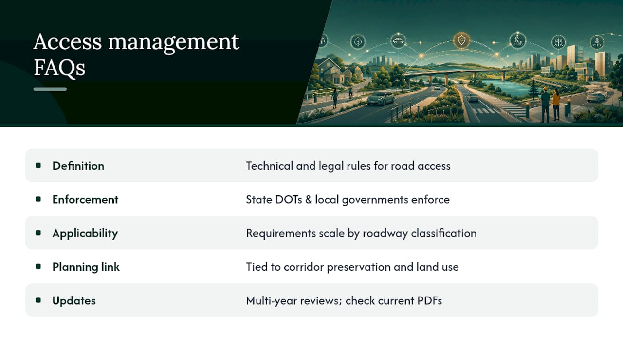
Revisions vary by agency, but most state DOTs review access management manuals on a multi-year cycle and post updates on their standards pages, which is another reason to pull the current PDF rather than rely on an older copy.
Sources
- What is access management? — FHWA Office of Operations
- Access management standards — Virginia Department of Transportation (VDOT)
- Access management — Florida Department of Transportation (FDOT)
- Access Management Standards — Randall County (PDF)