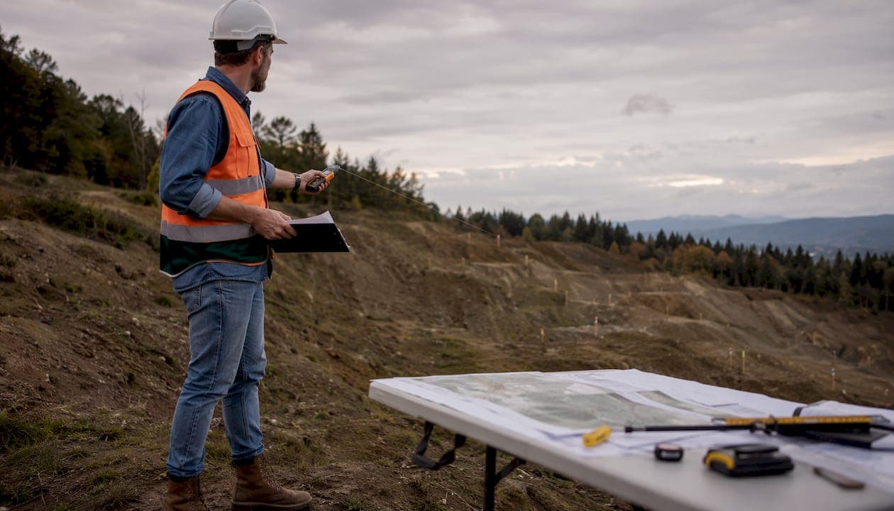
An ALTA/NSPS Land Title Survey is defined as a specialized boundary and title survey meeting the Minimum Standard Detail Requirements set jointly by the American Land Title Association and the National Society of Professional Surveyors. ALTA survey requirements exist to give lenders, title insurers, and buyers a legally defensible picture of a property's boundaries, easements, encroachments, and physical conditions before a commercial transaction closes. The 2026 standards, which took effect february 23, 2026, introduced significant changes to surveyor duties, Table A items, and deliverable formats. For real estate professionals and landowners in Mississippi, understanding these updates is not optional. It is the difference between a clean closing and a costly delay.
What are the core ALTA survey requirements under 2026 standards?
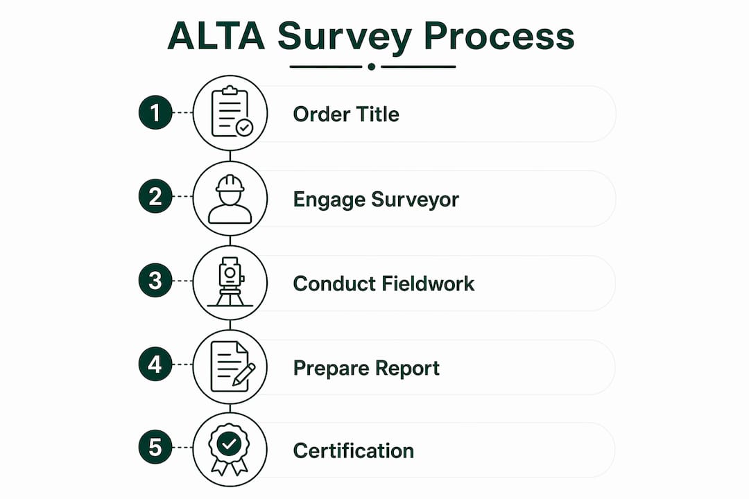
The 2026 ALTA/NSPS Minimum Standard Detail Requirements govern every element of a compliant survey, from fieldwork to final certification. Any survey contract signed after february 23, 2026 must meet these updated standards. The changes are not cosmetic. They expand surveyor responsibilities and restructure how deliverables are organized.

Fieldwork and research mandates
The 2026 standards shift adjoining deed research directly to the surveyor, who must now seek out quasi-public documents and property owner statements as part of the standard scope. This protects the title insurer and buyer from gaps that previously fell through the cracks. Surveyors must also locate and document all visible utilities, improvements, and encroachments on the survey plat.
The survey plat itself must include:
- Property boundaries with bearings and distances
- Adjoining owner names and recording references
- All easements and rights-of-way identified in the title commitment
- Visible encroachments across boundary lines
- Location of all improvements on or near the property
Surveyor certification and Table A items
The surveyor's certification is legally binding under 2026 standards. It forms the basis for removing survey exceptions from the title insurance policy. Without a properly worded certification, the title insurer cannot modify coverage.
Table A items divide into mandatory and optional categories. Mandatory items are included in every ALTA survey. Optional items are negotiated between the client and surveyor before fieldwork begins. Key optional items include:
- Flood zone classification (Item 6)
- Parking counts and dimensions (Item 7)
- Building setback lines (Item 9)
- Underground utilities (Item 11)
- Observed physical conditions summary (Item 20, new in 2026)
Table A Item 20 is a significant addition. It replaces narrative-only descriptions with a structured summary table of observed physical conditions and encroachments. Title professionals can now review encroachment data faster and with less ambiguity.
Pro Tip: Confirm your Table A selections with your lender before the surveyor begins fieldwork. Returning to the site for added scope items after the initial visit adds cost and delays your closing.
How do ALTA survey requirements affect cost and timing?
A standard ALTA/NSPS Land Title Survey for a commercial parcel under 5 acres costs $3,000–$8,000 in 2026. That range reflects base scope only. Table A selections, site complexity, and terrain all push costs higher.
Cost drivers and budget planning
The single largest cost variable is Table A Item 11, underground utility locating. Item 11 can add between $1,000 and $25,000 to a survey budget, depending on site complexity and whether the surveyor must subcontract a specialized utility locating service. Sites above 20 acres regularly exceed $25,000 in total survey costs.
| Cost Factor | Typical Impact |
|---|---|
| Base survey, under 5 acres | $3,000–$8,000 |
| Sites over 20 acres | Above $25,000 |
| Table A Item 11 (utilities) | $1,000–$25,000 added |
| Rush service surcharge | 30–50% added to base cost |
Mississippi properties with irregular terrain, wetlands, or complex access roads fall on the higher end of these ranges. Surveyors working in rural counties may also charge travel premiums.
Turnaround times and rush options
Standard ALTA survey turnaround is 2–3 weeks. The timeline depends more on title document availability and lender deadlines than on the physical survey work itself. Rush service compresses delivery to 5–7 business days, but adds 30–50% to the total cost.
The most common cause of timeline delays is a missing or incomplete title commitment. Surveyors cannot finalize easement and encumbrance research without it. Providing the title commitment and all relevant deed documentation at the time of order is the single most effective way to protect your schedule.
Pro Tip: Order the title commitment from your title company before you engage the surveyor. Handing both documents to the surveyor on day one eliminates the most common source of delays.
What practical steps ensure compliance with 2026 ALTA survey requirements?
Compliance with the 2026 standards requires preparation before the surveyor ever sets foot on the property. Real estate professionals and landowners who treat the survey as a last-minute task routinely face scope gaps and transaction delays.
Follow these steps to stay on track:
- Obtain the title commitment first. The surveyor needs Schedule B exceptions to identify easements and encumbrances. Without it, the survey scope is incomplete.
- Confirm Table A items with your lender. Major commercial lenders including SBA, Fannie Mae, Freddie Mac, CMBS, and HUD/FHA specify Table A items by loan type. Verify the required list before ordering.
- Specify 2026 ALTA/NSPS standards explicitly in your order. Do not assume the surveyor defaults to the current version. State it in writing.
- Update your survey order checklist. The 2026 addition of Item 20 caused renumbering of subsequent Table A items. Checklists based on older standards will reference wrong item numbers, creating scope errors.
- Coordinate site access early. Locked gates, active tenants, and security protocols in Mississippi commercial properties regularly delay fieldwork by days. Arrange access before the surveyor schedules the site visit.
Pro Tip: Ask your surveyor to confirm in writing which version of the ALTA/NSPS standards governs your contract. This one step prevents disputes over scope and deliverables at closing.
The 2026 standards also permit drones, LiDAR, and aerial imagery as survey methods. The standards are technology-neutral, meaning surveyors can choose the method that best fits the site. For large or difficult terrain sites in Mississippi, this flexibility can reduce fieldwork time and cost. Confirm with your lender that the chosen method meets their specifications before fieldwork begins.
How does an ALTA survey differ from a standard boundary survey?
A standard boundary survey establishes property corners and lines. It does not include title research, easement documentation, encroachment analysis, or Table A items. An ALTA survey does all of that and more.
The distinction matters because title insurance coverage depends on it. A boundary survey alone does not satisfy lender requirements for commercial transactions. The surveyor's certification under ALTA standards is what allows the title insurer to remove survey exceptions from the policy.
| Feature | Boundary Survey | ALTA/NSPS Survey |
|---|---|---|
| Property corners and lines | Yes | Yes |
| Deed and title research | No | Yes |
| Easements and encroachments | Limited | Full documentation |
| Table A optional items | No | Yes |
| Lender and title insurer acceptance | Rarely | Standard requirement |
| Surveyor certification for title policy | No | Yes |
ALTA surveys encompass title research, certification, easements, encroachments, and Table A items to satisfy lender and title insurer requirements. A boundary survey cannot substitute for this scope in a commercial transaction. The cost difference between the two survey types reflects the additional research, documentation, and legal responsibility the ALTA standard places on the surveyor.
For landowners in Mississippi considering a sale or refinance, the practical implication is clear. If a lender is involved, an ALTA/NSPS survey is required. A boundary survey will not clear the title exceptions that lenders need removed. Paying for the right survey type from the start avoids the cost of ordering a second survey after the lender rejects the first.
Key Takeaways
ALTA survey requirements under the 2026 ALTA/NSPS Minimum Standard Detail Requirements are the non-negotiable foundation for title insurance coverage and commercial lender approval in any Mississippi property transaction.
| Point | Details |
|---|---|
| 2026 standards are now in effect | Any survey contract after february 23, 2026 must comply with the updated ALTA/NSPS requirements. |
| Surveyor research duties expanded | Surveyors now carry responsibility for adjoining deed research and quasi-public document review. |
| Table A Item 20 is new | This item requires a structured summary of observed conditions, replacing narrative-only descriptions. |
| Costs range widely | Base surveys run $3,000–$8,000; Table A Item 11 alone can add up to $25,000 for complex sites. |
| ALTA surveys are not interchangeable with boundary surveys | Only an ALTA/NSPS survey satisfies lender and title insurer requirements for commercial transactions. |
What I've learned from watching ALTA surveys derail commercial closings
Working through commercial land transactions across Mississippi, I've seen one pattern repeat more than any other. The survey gets ordered too late, with the wrong checklist, and without the title commitment in hand. The result is a 2–3 week delay that could have been avoided with one phone call made two weeks earlier.
The 2026 standard changes are genuinely meaningful, not just administrative updates. The shift of adjoining deed research to the surveyor adds real protection for buyers and title insurers. But it also adds time and cost to the surveyor's scope. Real estate professionals who budget and schedule based on pre-2026 assumptions will be caught short.
The technology provisions in the 2026 standards are worth paying attention to. Drones and LiDAR are now explicitly permitted, and for large Mississippi properties with difficult terrain, this can meaningfully reduce fieldwork time. The catch is that not every lender has updated their internal specs to accept remotely sensed data. Always verify with the lender before the surveyor commits to a method.
My strongest advice is this: treat the ALTA survey as a due diligence document, not a closing formality. The commercial due diligence process in any jurisdiction rewards professionals who engage surveyors early, provide complete documentation upfront, and confirm Table A requirements with lenders before fieldwork begins. The survey is where title problems surface. The earlier you get it, the more time you have to resolve them.
— Jeremy
How Urban Planning Pros supports your ALTA survey and land planning needs
Real estate professionals and landowners in Mississippi face a more complex survey environment in 2026 than they did two years ago. Urban Planning Pros brings the planning expertise to help you prepare for and coordinate ALTA surveys as part of a broader feasibility and land planning process.

Urban Planning Pros evaluates property documents, zoning constraints, and site conditions before survey work begins. This preparation reduces the risk of scope gaps and keeps transactions on schedule. Whether you are acquiring a commercial parcel, refinancing, or planning a development, the team at Urban Planning Pros coordinates the documentation and due diligence steps that make your land planning services work efficiently from the first site review to final closing.
FAQ
What is an ALTA survey?
An ALTA survey is a land title survey meeting the joint standards of the American Land Title Association and the National Society of Professional Surveyors. It documents boundaries, easements, encroachments, and other conditions required by lenders and title insurers for commercial transactions.
When did the 2026 ALTA/NSPS standards take effect?
The 2026 Minimum Standard Detail Requirements took effect february 23, 2026. Any survey contract signed after that date must comply with the updated standards.
How much does an ALTA survey cost in 2026?
A standard ALTA survey for a commercial parcel under 5 acres costs $3,000–$8,000. Large sites, complex terrain, and optional Table A items such as underground utility locating can push total costs above $25,000.
What is Table A in an ALTA survey?
Table A is a list of optional items that clients can add to the standard ALTA survey scope. Items include flood zone classification, parking counts, building setbacks, and underground utilities. Lenders often specify which Table A items are required based on loan type.
Can a boundary survey replace an ALTA survey for a commercial transaction?
A boundary survey cannot replace an ALTA survey for commercial lender or title insurer requirements. Only an ALTA/NSPS survey includes the title research, certification, and Table A documentation needed to remove survey exceptions from a title insurance policy.