
A future land use map (FLUM) is the comprehensive plan's official map of a community's intended land use pattern, showing where housing, commerce, industry, and open space should grow over time. It carries policy weight, not regulatory force. If you need the version that actually governs a parcel, start with the municipal comprehensive plan page or the city's GIS mapserver, not a third-party real estate site.
The immediate move for anyone evaluating a property:
- Pull the adopted comprehensive plan and locate its FLUM exhibit or interactive dashboard
- Cross-check the parcel against the city's GIS mapserver layer for the coded designation
- Note the ordinance number tied to the current designation before assuming anything about buildability
Key Takeaways
A future land use map sets policy direction for a parcel, but only the zoning ordinance and adopted zoning map determine what you can legally build today.
| Point | Details |
|---|---|
| FLUM is guidance, not law | The comprehensive plan's FLUM signals intended character; the zoning map is the enforceable regulatory document. |
| Always check the coded legend | GIS layers store numeric codes for categories, and every jurisdiction assigns them differently. |
| Confirm the ordinance number | The current designation ties to a specific adopted ordinance; cite it when researching parcel history. |
| Rezoning follows a set process | Expect a narrative, concept plan, public notice, hearings, and a vote, often within an 8 to 12 week window. |
| Professional review reduces risk | Urban Planning Pros extracts FLUM data and checks it against zoning and infrastructure capacity before you file. |
Table of Contents
- What Does a Future Land Use Map Actually Show?
- Where Can You Find the Official Future Land Use Map?
- Is a Future Land Use Map the Same as a Zoning Map?
- How Do You Use a FLUM to Evaluate a Property?
- What Do You Need to File or Track a Zoning Map Amendment?
- When Should You Bring in a Planning Consultant?
- How Does a FLUM Account for Environmental and Sustainability Goals?
- Why Do Future Land Use Maps Get Misread So Often?
- How Have Future Land Use Maps Changed Real Outcomes?
- Reading These Maps for a Living Changes How You See Risk
- Get Professional Help Interpreting Your Parcel's Designation
- Sources
What Does a Future Land Use Map Actually Show?
A FLUM assigns every parcel in a jurisdiction a category describing its intended long-term character. Most municipal maps use variations on the same core set: single-family residential, multi-family residential, mixed-use, activity centers, commercial corridors, civic/institutional, and open space or conservation. Some cities layer in specialized categories for industrial corridors, transit-oriented districts, or rural preservation.
Reading the legend correctly matters more than memorizing category names, because every city codes things a little differently.
- Open the map's legend before you interpret a single color or pattern on the exhibit.
- Check whether the GIS layer stores a numeric or alphanumeric code, then confirm what that code maps to in the layer's field metadata. Austin's future land use layer, for example, stores coded values like 100 for single-family and 330 for mixed-use categories.
- Watch for annotations on the adopted PDF that don't always survive into the GIS aggregation, like parcel-specific notes or council-approved exceptions.
- Look for a "guidance" versus "limit" distinction in the plan text itself. Some FLUMs specify density ranges (units per acre); others describe character only, leaving numbers to the zoning code.
Pro Tip: Never treat a FLUM category as a hard cap on density or use. It signals intent. The zoning ordinance sets the enforceable number.
Where Can You Find the Official Future Land Use Map?
Every jurisdiction publishes its FLUM a little differently, but the pattern is consistent enough to search for directly.
- Start with the city or county's comprehensive plan page, usually under a "Planning" or "Long Range Planning" department tab.
- Look for a "Maps & Data" or "GIS Portal" link, which typically hosts an interactive dashboard alongside downloadable data.
- Search for the jurisdiction's ArcGIS REST endpoint directly. Fayetteville, Arkansas, for example, publishes its future land use layer as a standard MapServer service viewable in ArcGIS Online, ArcGIS Pro, or any compatible viewer app.
- Download formats vary: expect PDF for the adopted plan exhibit, and GeoJSON or shapefile for the GIS layer itself.
Before using any downloaded layer, check four things in the metadata: the ordinance number tied to the last amendment, the date of the most recent update, the spatial reference system, and the legend's coded values. Fayetteville's mapserver metadata explicitly flags that GIS aggregations may not capture every council-adopted notation present on the official PDF, which is exactly the kind of gap that trips up a quick property search.
Is a Future Land Use Map the Same as a Zoning Map?
No, and the distinction determines what you can legally build. A FLUM is policy guidance adopted as part of the comprehensive plan. It describes the community's intended vision for how land should develop over a 10 to 20 year horizon. A zoning map, by contrast, is regulatory and enforceable the moment it's adopted, setting the actual permitted uses, densities, and dimensional standards for a parcel today.
Municipal FLUM pages state this plainly: the future land use map guides decisions about housing, employment, and natural area protection but does not establish zoning district boundaries on its own. A parcel can show "Mixed-Use" on the FLUM while still carrying a single-family zoning designation that hasn't caught up yet. That gap is precisely where rezoning requests originate.
A zoning map amendment, or rezoning, is a legislative act. It typically follows this sequence:
- Pre-application meeting with planning staff to gauge feasibility and flag obvious conflicts.
- Formal application, including a written narrative justifying the request and a concept plan showing site geometry, dimensions, and surrounding context.
- Public notice to adjacent property owners and posting of the site.
- Public hearings before a planning commission and then the governing body.
- A vote, sometimes requiring a supermajority if a qualified protest petition from neighboring owners is filed.
Legal glossaries describing rezoning consistently note it must align with the comprehensive plan and survive public hearing scrutiny, which is why a FLUM designation that already supports your intended use makes the whole process faster and less contentious. Municipal review timelines commonly run 8 to 12 weeks from application to governing-body action in routine cases, though contested rezonings or ones requiring plan amendments stretch well beyond that.
How Do You Use a FLUM to Evaluate a Property?
A FLUM becomes useful the moment you convert its category label into a feasibility signal. Run through this sequence on any parcel you're evaluating:
- Confirm the exact FLUM designation and pull the ordinance number tied to it.
- Cross-check current zoning against the FLUM category. Alignment means a straightforward path; mismatch means you're looking at a rezoning process before anything gets built.
- Check for overlay districts, floodplain notations, or preservation boundaries layered on top of the base designation.
- Review the comprehensive plan's infrastructure and capital improvement policies for the area. A FLUM category won't help you if the sewer capacity isn't there yet.
- Note whether the parcel sits inside a designated activity center or redevelopment priority area, which often signals faster approval and sometimes incentives.
Open-space, conservation, or agricultural preservation designations are the clearest red flag. Reversing them usually requires a plan amendment, not just a rezoning, which is a longer and more politically sensitive process. Planned corridors and mixed-use centers are the opposite signal: municipalities designate them specifically to attract the density and use types investors are looking for.
Pro Tip: Model your rezoning odds before you buy, not after. A parcel whose zoning already matches its FLUM designation is a fundamentally different risk profile than one that needs a full legislative rezoning to reach the same outcome.
What Do You Need to File or Track a Zoning Map Amendment?
Filing a rezoning request means assembling a specific package, and most jurisdictions won't accept an incomplete one.
- Completed application form with the property's legal description and current zoning classification.
- Written narrative explaining the requested change, the justification for it, and its anticipated impact on surrounding properties.
- Concept or development plan showing basic site geometry, dimensions, easements, and any environmental features like floodplain boundaries. Roanoke's zoning amendment process guide lays out these concept plan minimums in detail.
- Application fee, which varies by jurisdiction and parcel size.
- Written authorization from the property owner if the applicant isn't the owner of record.
Once filed, expect written notice to go out to adjacent property owners ahead of the public hearing, followed by planning commission review and then a governing-body vote. Roanoke's process guide notes that rezoning success often depends more on demonstrating comprehensive plan consistency and addressing neighborhood concerns proactively than on the technical polish of the application itself. That's exactly where bringing in legal counsel or a planner earns its cost, particularly on any request that touches infrastructure capacity, environmental overlays, or organized neighborhood opposition.
When Should You Bring in a Planning Consultant?
Some FLUM situations are simple enough to handle with a phone call to the planning department. Others aren't. Complex rezoning requests, mixed-use concepts spanning multiple parcels, large-site feasibility studies, and any project where infrastructure capacity is genuinely uncertain all justify professional involvement before you file anything.
Consultants working with FLUMs typically deliver:
- GIS extraction of coded designations across every parcel in a target assemblage
- A consistency analysis comparing current zoning against the FLUM category, flagging where a formal rezoning will be required
- Narrative and concept plan preparation built to withstand hearing scrutiny, not just satisfy a checklist
- Application management through notice periods, commission review, and the governing-body vote
A parcel that looks straightforward on a FLUM legend can still carry infrastructure gaps, overlay restrictions, or a fragmented ownership history that only surfaces once someone extracts the coded data at the parcel level and checks it against zoning, utility capacity, and the adopted ordinance record.
Land planning services built around this kind of parcel-level extraction and consistency analysis are what separate a feasibility study that catches problems early from one that only confirms what you already assumed.
How Does a FLUM Account for Environmental and Sustainability Goals?
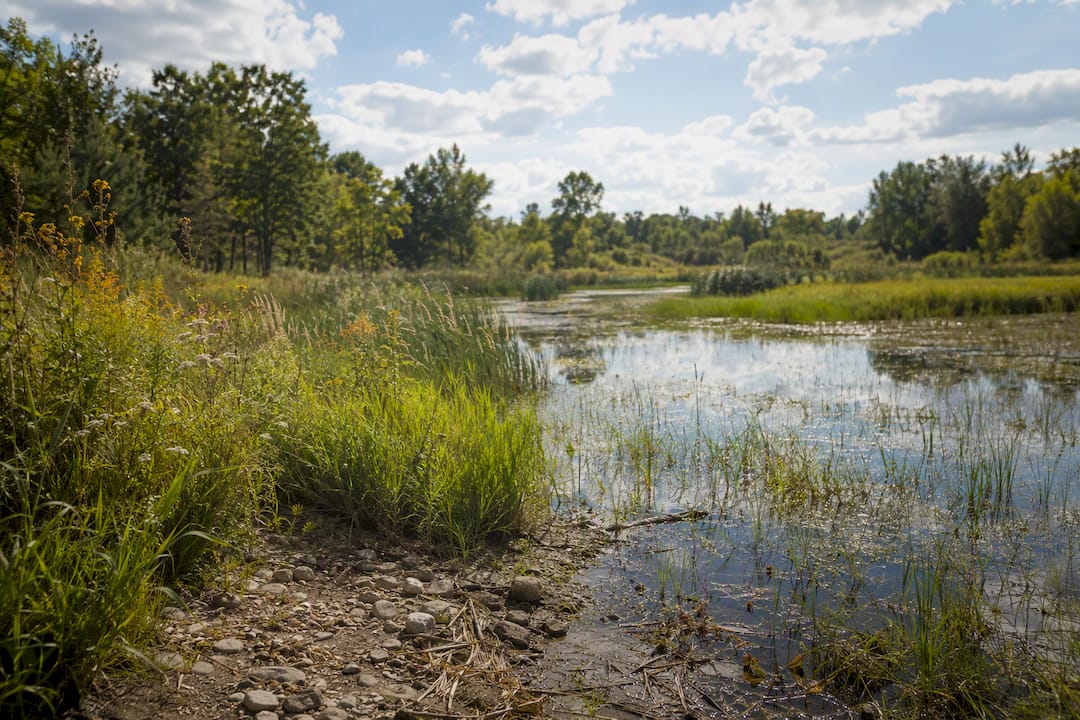
Comprehensive plans increasingly use the FLUM as the mechanism for steering growth away from environmentally sensitive land and toward areas that can absorb it. Open space, conservation, and floodplain overlay categories aren't decorative; they represent a jurisdiction's attempt to keep development out of wetlands, floodways, and habitat corridors before a permit application ever gets filed.
Density-focused categories like activity centers and mixed-use corridors serve a related sustainability function. Concentrating growth into designated centers reduces sprawl pressure on undeveloped land at the urban edge and supports the kind of walkable, transit-adjacent development that lowers per-capita infrastructure cost. When a FLUM channels multi-family and mixed-use designations along existing corridors instead of scattering them across greenfield sites, that's usually a deliberate planning choice tied to the jurisdiction's environmental and capital improvement policies, not an accident of the mapping process.
For property owners, this cuts both ways. A parcel bordering a protected natural area may carry a conservation designation that severely limits development potential, and reversing it typically requires a plan amendment rather than a simple rezoning. On the other hand, a parcel sitting inside a designated growth corridor or activity center often benefits from streamlined review specifically because the jurisdiction wants density there.
The practical takeaway: always check whether a parcel's FLUM designation ties into an environmental overlay, stormwater management policy, or tree canopy preservation requirement before assuming a category name tells the whole story. The label "Mixed-Use" means something different next to a protected wetland than it does along a commercial corridor with full utility capacity.
Why Do Future Land Use Maps Get Misread So Often?
The single biggest source of confusion is treating a FLUM category as an enforceable rule instead of a policy statement. A parcel marked "Commercial" on the FLUM can sit on land still zoned agricultural, and nothing about the map itself changes what's legally permitted today.
GIS aggregation introduces a second layer of risk. Coded polygon layers are convenient for quick lookups, but they periodically lag behind council-adopted amendments, and they can flatten parcel-specific notations that exist only on the official PDF exhibit. Fayetteville's own mapserver documentation carries a direct warning about this gap, and it's not unique to that jurisdiction.
Boundary precision is another common trap. FLUM polygons are drawn at a planning scale, not a survey scale, so a designation line running near a property boundary may not align exactly with the parcel's legal description. Relying on a FLUM exhibit alone to determine which category governs a specific parcel edge is a mistake worth avoiding, especially on irregular or subdivided lots.
Update lag causes real problems too. Comprehensive plans typically update on multi-year cycles, and public participation processes, from advisory committee review to public hearings, can stretch amendment timelines out well beyond a single budget cycle. A FLUM that hasn't been revisited recently may not reflect current market reality or infrastructure investment, even though it remains the legally adopted document until amended.
Finally, category definitions aren't standardized nationally. "Mixed-Use" in one jurisdiction might permit ground-floor retail with residential above; in another, it might mean strictly commercial with residential prohibited outright. Always read the comprehensive plan's own definition section rather than assuming a category name means what it meant in the last city you researched.
How Have Future Land Use Maps Changed Real Outcomes?
FLUM amendments happen constantly, and the pattern behind most of them is predictable once you've seen a few play out. A corridor that was purely commercial for decades gets reclassified as mixed-use once a jurisdiction decides it wants residential density near existing retail and transit. Once that FLUM change is adopted, it doesn't rezone anything automatically, but it opens the door for property owners along that corridor to request rezoning with a much stronger consistency argument than they'd have had before the amendment.
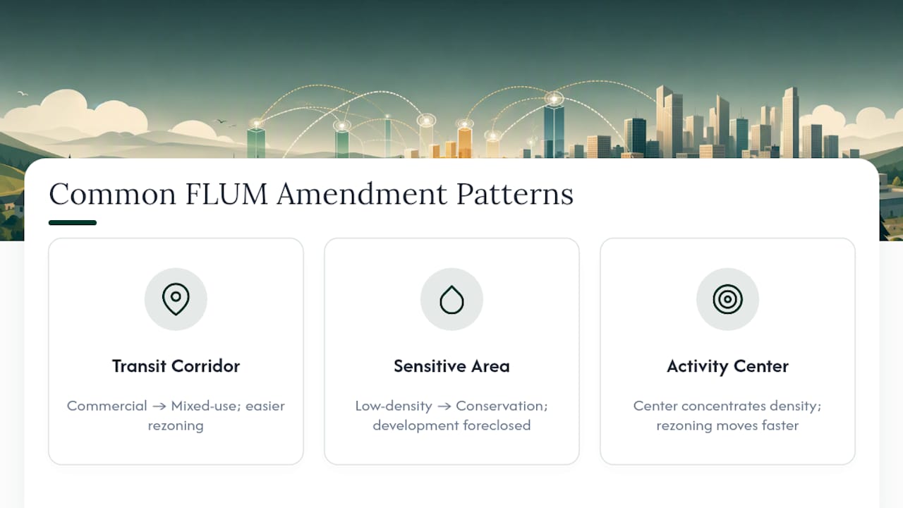
The reverse pattern shows up just as often near environmentally sensitive areas. A parcel that carried a low-density residential designation for years can get reclassified as conservation or open space after a wetlands study, a flood event, or a habitat assessment prompts the jurisdiction to revisit that section of the plan. Owners who bought expecting future subdivision potential sometimes find that potential eliminated by a plan amendment they never tracked.
Activity center designations tell a third story. Jurisdictions frequently carve out a designated center around an existing highway interchange or transit stop specifically to concentrate the density and mixed-use development that would otherwise face resistance if proposed piecemeal parcel by parcel. Once that center designation exists on the FLUM, individual rezoning requests inside its boundary tend to move faster and face less organized opposition, because the policy groundwork and public input process already happened at the plan level rather than the parcel level.
The common thread across all three patterns: FLUM amendments create or foreclose opportunity years before a single building permit gets pulled. Watching plan amendment cycles in your target area, not just current zoning, is often the earliest signal available.
Reading These Maps for a Living Changes How You See Risk
Anyone who has spent time cross-referencing coded FLUM layers against adopted zoning ordinances develops a healthy suspicion of maps that look too clean. The parcels that create the most trouble aren't the ones with an obvious conflict between zoning and FLUM designation. They're the ones where the two documents technically agree, but an overlay, an infrastructure policy, or a stale update date buried in the plan text quietly changes what's actually achievable.
. Feasibility work built around FLUM interpretation tends to reward the same habit every time: pull the ordinance number, check the update date, and read the plan's own definitions section before trusting a category label at face value..
Verify the official data yourself before making a decision, and reach out for help interpreting a specific parcel if the picture isn't clear.
Get Professional Help Interpreting Your Parcel's Designation
Reading a FLUM legend correctly is one thing. Knowing whether a parcel's designation, zoning, overlays, and infrastructure capacity actually line up for the project you want to build is another matter entirely, and it's where most owners underestimate the work involved.

Urban Planning Pros builds feasibility studies around exactly this kind of parcel-level analysis: extracting the coded FLUM designation, cross-checking it against current zoning, and flagging overlays or infrastructure gaps before you commit capital to a site. That upfront work is what keeps a rezoning application from stalling at the hearing stage over a consistency issue nobody caught early. For projects spanning multiple parcels or a longer development horizon, master land planning folds that same FLUM analysis into a full market and infrastructure review. And if you're weighing whether a consultant's fee is worth it against handling the process yourself, resources like a town planner cost calculator offer a useful budgeting reference point.
Request an initial review of your parcel's FLUM designation and zoning status before you file anything with the planning department.
Sources
- Zoning Amendment Process Guide — Roanoke, VA (June 2026)
- Future_Land_Use (MapServer) — Fayetteville map server
- Future Land Use Map & Dashboards — Planocompplan
- Rezoning | City of Madison development services