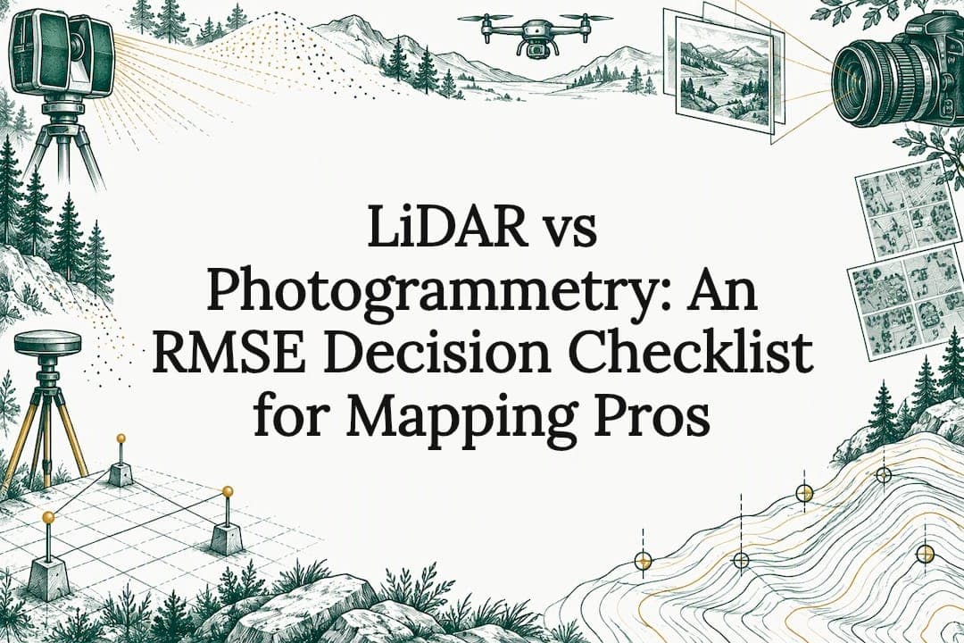
Use LiDAR when a project needs direct, reliable geometry through vegetation or in low light. Use photogrammetry when the deliverable calls for color-rich, textured models in well-lit, well-textured scenes. Choose a hybrid workflow when both geometry and texture carry contractual weight, and treat any accuracy claim as conditional on platform, control, and the specific metric being reported.
TL;DR:
- LiDAR provides better vertical accuracy in vegetated or complex terrain, especially under low-light conditions, while photogrammetry excels in open, well-lit, textured scenes.
- Combining both methods in a hybrid workflow offers the highest fidelity when geometric precision and visual realism are both critical for project deliverables.
- Accurate results rely heavily on site conditions, proper control point deployment, and thorough pre-capture planning, with errors tied to GNSS, camera calibration, and control placement.
- Equipment costs are less significant than crew time, re-flights, and manual cleanup efforts, which can outweigh hardware savings, especially in challenging terrain.
- Validation with independent checkpoints and adherence to industry accuracy standards are essential for defensible, high-quality final datasets.
Table of Contents
- How LiDAR and photogrammetry work: sensing principles and native outputs
- Accuracy and error budgets: what accuracy actually means
- Data capture and processing workflows: field planning to deliverable
- Environmental performance and deliverable fit: match method to site
- Cost, equipment, and time trade-offs: realistic budgeting for projects
- Validation, standards, and quality control: the checklist professionals use
- Hybrid workflows and best practices: combining geometry with texture
- Decision framework: a checklist for choosing the right approach
- What this means for feasibility and master planning work
- How Urban Planning Pros supports your capture and planning decisions
- FAQ
- Sources
How LiDAR and photogrammetry work: sensing principles and native outputs
The two methods start from different physics, and that difference explains almost everything downstream. LiDAR is an active sensor: it emits laser pulses and measures return time to calculate distance, which lets it penetrate dense vegetation and operate independently of ambient lighting. Photogrammetry is passive. It reconstructs geometry from overlapping photographs using structure-from-motion triangulation, so it depends on consistent light and visible surface detail to find matching points across images.
That distinction shows up directly in what each method hands you at the end of a capture:
- LiDAR outputs a point cloud with intensity values, return number, and classification codes, plus derived DSM and DTM surfaces.
- Photogrammetry outputs a dense point cloud, a textured mesh, and an orthophoto built from calibrated camera positions.
- LiDAR point clouds can carry RGB when paired with an onboard camera, blurring the line between the two outputs.
- Photogrammetric meshes carry true photographic texture, which LiDAR alone cannot generate.
Platform choice shapes which outputs are practical. Terrestrial laser scanners (TLS) deliver dense, millimeter-level detail for small sites and facades. Mobile mapping systems trade some density for speed across corridors and street scapes. UAS platforms, carrying either lidar or camera payloads, cover moderate acreage efficiently, and manned aircraft remain the standard for large regional or statewide collections where flight time and sensor cost justify the scale.
Accuracy and error budgets: what accuracy actually means
"More accurate" is meaningless without a metric attached. Horizontal accuracy (RMSEx, RMSEy) and vertical accuracy (RMSEz) behave differently and respond to different error sources, and a dataset can be strong in one while weak in the other. ASPRS guidance pushes the industry toward a sensor-agnostic, RMSE-driven approach, meaning accuracy classes and reporting requirements apply the same way whether the data came from a laser or a camera.
Statistic: UAS lidar accuracy assessments find horizontal accuracy achievable across varied conditions, while vertical accuracy is far more sensitive to ground control quality and trajectory processing choices. In practice, that means two crews flying the same lidar sensor over the same site can produce materially different vertical results if their GNSS base station setup or trajectory solution differs.
The error contributors split cleanly by method:
- LiDAR accuracy depends on GNSS and IMU precision, trajectory smoothing, and how well overlapping swaths align with each other.
- Photogrammetric accuracy depends on camera calibration, image overlap percentage, and the spatial distribution of ground control points (GCPs) across the site, not just their count.
- Both methods degrade when scale constraints are weak, meaning too few control points or control points clustered in one corner of the site.
- Both require independent checkpoints, points withheld from processing and used only to validate the final result, to produce a defensible accuracy report.
ASPRS recommends building the error budget before capture begins: set separate RMSE targets for vertical and horizontal accuracy, then allocate tolerance to the sensor-specific sources above. Skipping that step is the single most common reason a delivered dataset fails review.
Data capture and processing workflows: field planning to deliverable
Planning decisions made before a crew ever leaves the office determine most of the final accuracy and cost. For photogrammetry, ground sample distance (GSD), front and side overlap, and flight altitude set the resolution ceiling. For lidar, pulse density, scan angle, and flight speed set point density and shadow coverage.
Processing follows a predictable sequence for each method:
- Photogrammetry: align images via structure-from-motion, densify the point cloud, build a mesh, then generate the orthophoto and texture.
- LiDAR: classify ground versus non-ground returns, check swath-to-swath registration, then derive the DSM and DTM surfaces.
- Both pipelines finish with a QA pass comparing the output against withheld checkpoints before delivery.
Common failure modes are specific enough to plan around. Photogrammetry struggles on homogeneous surfaces such as wet pavement, still water, or fresh snow, where the software cannot find distinct matching points between images. LiDAR struggles with boresight errors, small misalignments between the sensor and IMU, that show up as systematic offsets between flight lines. Both are mitigated the same way: redundant overlap, stable mounting, and a QA pass before the crew leaves the site rather than after.
Pro Tip: Run a quick visual check of swath overlap or image overlap in the field before packing up. Catching a gap on site costs an hour; catching it in the office costs a re-flight.
Software for each workflow falls into two broad categories: SfM-based photogrammetry suites for image processing, and point-cloud processing platforms for lidar classification and surface generation. Most professional pipelines now use both, regardless of which sensor did the capture.
Environmental performance and deliverable fit: match method to site
Site conditions, more than sensor specs, usually decide which method produces a usable result.
- LiDAR holds its advantage in forest canopy, low-light conditions, and dusk-to-dawn operations, since it does not depend on ambient light or a clear line of sight to bare ground.
- Photogrammetry holds its advantage in open, well-lit, texture-rich scenes, where it delivers photorealistic, colorized meshes at a lower hardware cost.
- Both methods struggle over open water and highly reflective or glossy surfaces, where laser returns scatter and photo matching fails for different reasons.
- Dense canopy remains a hard limit for photogrammetry even with heavy overlap, since cameras simply cannot see through foliage the way a laser pulse partially can.
Matched against common deliverables, the pattern holds steady: forestry and vegetated terrain favor lidar, coastal and bathymetric work needs method-specific caveats around water penetration, construction as-built documentation often favors lidar for speed and geometric reliability, cultural heritage and interior capture frequently favor photogrammetry for its visual fidelity, and large open sites with clear ground cover can go either way depending on budget.
Cost, equipment, and time trade-offs: realistic budgeting for projects
Hardware price comparisons are the least useful number in this decision. The real cost lives in crew time, re-flights, and processing labor, and it shifts depending on site complexity rather than sensor type alone.
- Lidar payloads carry a higher upfront equipment cost but typically need fewer re-flights on vegetated or low-light sites.
- Photogrammetry-capable camera systems cost less to acquire but can require repeat passes when lighting changes mid-capture or ground control is thin.
- Classification QA on lidar point clouds adds processing labor that is easy to underestimate when scoping a project timeline.
- Complex or operationally demanding captures, including UAS work requiring a hired operator, carry crew and logistics costs that often exceed the hardware line item; services like FPV drone operation illustrate how operational complexity, not just equipment, drives the final invoice.
The apparent savings of a camera-only workflow tend to disappear on sites with mixed vegetation, variable lighting, or tight accuracy tolerances, where the re-flight and manual cleanup costs quietly erase the hardware discount.
Validation, standards, and quality control: the checklist professionals use
Delivered accuracy is only defensible when it is tested against an independent standard, not asserted from processing software output. ASPRS's positional accuracy framework treats lidar and photogrammetry under the same sensor-agnostic, RMSE-based reporting structure, which means a reviewer can compare datasets from different sensors using the same language.
Statistic: A USGS dual-sensor pilot project in Colorado found that an airborne lidar-plus-imagery collection could meet 3DEP geometric accuracy requirements while supporting combined geometry and imagery objectives in a single pass, evidence that hybrid collection is not just theoretically sound but operationally workable at production scale.
A practical field QC checklist should include:
- Independent checkpoints surveyed separately and withheld from the processing workflow entirely.
- GCPs reserved and excluded from the bundle adjustment, used only to score the final result.
- Swath-overlap checks comparing elevation values in the overlap zones between adjacent flight lines.
- Cross-section comparisons against known features, curbs, rail lines, or benchmarks, to catch systematic vertical offset.
Hybrid workflows and best practices: combining geometry with texture
Hybrid capture earns its added cost when tolerances are tight enough that geometry alone will not satisfy the deliverable, or when the project feeds a BIM model or digital twin that needs both reliable coordinates and visual realism. Industry guidance increasingly favors combining lidar's geometric reliability with photogrammetric texture rather than forcing one sensor to do both jobs.
The practical sequence: capture lidar first to establish geometric control, then capture imagery for texture, and register the two datasets against the same ground control network rather than against each other.

Pro Tip: Colorize the lidar point cloud using the registered imagery rather than treating the two datasets as separate deliverables. It forces a reconciliation check that catches misalignment early.
A short checklist for hybrid projects:
- Confirm both datasets share the same control network and coordinate system before processing begins.
- Reconcile classification differences between the lidar ground model and the photogrammetric mesh before final delivery.
- Document which dataset governs geometry and which governs texture in the final deliverable metadata.
Decision framework: a checklist for choosing the right approach
Scoping the right method starts with naming the variables that actually matter: vegetation cover, lighting conditions, required vertical accuracy, site size, and whether the deliverable feeds a visual model or a purely geometric one.
- Choose photogrammetry as the primary method when the site is open, well-lit, and texture-rich, and the deliverable needs visual realism more than strict vertical precision.
- Choose lidar as the primary method when vegetation, low light, or vertical accuracy requirements dominate the project's tolerance.
- Choose a hybrid capture when both geometric tolerance and visual fidelity carry contractual weight, such as BIM or digital twin deliverables.
- Before signing a vendor, require a written control plan, an accuracy report citing specific RMSE values, file formats matching the project's GIS or CAD environment, and metadata documenting the control network used.
What this means for feasibility and master planning work
In feasibility and master planning engagements, the method choice is never about which sensor is trendier. It comes down to what the site constraints and the client's tolerance for risk actually demand. A wooded parcel with wetland boundaries calls for lidar's ability to see through canopy, while a cleared infill site with historic facades often benefits more from photogrammetric texture. The right answer changes project to project, which is exactly why it gets decided during the planning phase rather than left to the survey crew.
— Jeremy Wenger
How Urban Planning Pros supports your capture and planning decisions
Choosing between lidar and photogrammetry is only useful when it is tied to a clear project scope, which is where Surveying Services and 3D laser scanning fit into a larger feasibility picture. Urban Planning Pros coordinates capture planning, fieldwork, and data QA alongside Feasibility Studies so the method serves the deliverable, not the other way around.
Bring your project goals, site size, terrain type, and accuracy tolerance to a scoped consultation, and the right capture method, lidar, photogrammetric, or hybrid, gets built into the plan from day one. Request a feasibility consultation to start.
FAQ
Is LiDAR more accurate than photogrammetry?
It depends on the metric and the site: lidar typically holds a vertical accuracy advantage in vegetated or complex terrain, while photogrammetry can match horizontal accuracy in cleared sites with strong ground control distribution. Neither method is categorically more accurate across every condition and metric.
What can LiDAR not detect?
LiDAR struggles over open water, glass, and highly reflective or glossy surfaces, where laser pulses scatter instead of returning a clean signal. It also cannot capture color or texture on its own, which is why many projects pair it with imagery.
Is LiDAR more expensive than photogrammetry?
Lidar sensors generally carry a higher upfront equipment cost than photogrammetry-capable camera systems, but photogrammetry projects can lose that apparent savings through re-flights and manual cleanup on vegetated or low-texture sites. The total cost comparison depends heavily on site complexity, not hardware price alone.
What are the downsides of LiDAR?
LiDAR cannot produce photorealistic texture on its own, and its vertical accuracy is sensitive to GNSS and trajectory processing quality. It also typically requires higher upfront equipment investment than camera-based systems.
Sources
- Photogrammetry vs LiDAR: How to Choose the Best 3D Scanning Method — Matterport
- Positional Accuracy Standards for Digital Geospatial Data — ASPRS
- Airborne lidar accuracy analysis for dual photogrammetric and lidar sensor pilot project in Colorado, 2019 — USGS OFR 2024
- Absolute 3D Accuracy Assessment of UAS LIDAR Surveying — NOAA repository