A deed transfers ownership; a plat is the recorded map showing how a parcel was divided into lots. Rely on the deed to prove you own the property, and rely on a current survey or plat to know exactly where your boundaries sit. When those two records disagree, or when you're financing, subdividing, or building near a line, order a new survey before you act on either document alone.
TL;DR:
- A current survey or plat is essential when deed records and boundary markers conflict, especially for financing, subdivision, or building near property lines.
- Deeds transfer ownership while plats provide the visual map of subdivided land; recorded plats define physical boundaries and easements that bind future owners.
- Discrepancies between deed descriptions and current surveys are often resolved by a licensed surveyor, with ground monuments prioritized over outdated paperwork.
- Creating new lots or resolving boundary disputes requires a licensed survey to verify ground conditions before legal or development actions.
- Proper subdivision approval and recorded plats ensure accurate property tax assessments and prevent conflicts caused by outdated or incorrect land descriptions.
Table of Contents
- Plat vs Deed: The Legal Function Behind Each Document
- What a Plat Is (and What It's Not)
- How Deeds and Plats Work Together in a Transaction
- When You Actually Need a New Survey or Plat
- Common Boundary Disputes and How They Get Resolved
- Legal Authority: Why a Deed Outranks a Plat (Usually)
- Real Conflicts Between Plats and Deeds, and How They Get Fixed
- Plats, Deeds, and the Subdivision Approval Process
- How Plats and Deeds Shape Property Taxes and Public Records
- The Practical Take: Stop Treating Records as Proof of Reality
- Sources
- FAQ
Plat vs Deed: The Legal Function Behind Each Document
A deed is the written instrument that actually moves title from one owner to the next. It's not the same thing as title itself, which is the abstract legal concept of ownership. The deed is the evidence of that transfer, the paper trail a court or title company points to when someone asks who owns a parcel.
Not all deeds carry the same weight. The three you'll encounter most often:
- Warranty deed: the seller guarantees clear title going back through the full chain of ownership, and promises to defend against future claims.
- Special warranty deed: the seller only guarantees the title was clear during their own ownership, not before.
- Quitclaim deed: the seller transfers whatever interest they have, with no guarantees at all. Common between family members or in divorce settlements.
For a deed to work, it needs a signature, notarization, and delivery to the buyer. But recording at the county level is what actually protects the buyer. An unrecorded deed can still be valid between the two parties, but recording gives the world constructive notice: it establishes the chain of title that lenders, title insurers, and future buyers all rely on to confirm nobody else has a competing claim.
What a Plat Is (and What It's Not)
A plat map is a certified survey showing how a tract of land was carved into individual lots. It's typically drawn by a licensed land surveyor and filed with the county before it becomes part of the public record. Once recorded, a subdivision plat becomes the reference point deeds use for their legal descriptions, which is why so many deeds simply cite "Lot 4, Block 2" instead of spelling out every boundary line in metes and bounds.
A recorded plat generally shows:
- Individual lot lines and block numbers
- Easements for utilities, drainage, or access
- Dedicated rights of way, streets, and public spaces
- Survey monuments marking corners and reference points
- The surveyor's certification and county approval stamps
Here's where confusion creeps in. A "plat" isn't automatically the same as a "plat of survey" or a "plot plan." A subdivision plat covers an entire tract broken into multiple lots at the time of development. A plat of survey, sometimes called a boundary survey, covers a single existing lot and confirms its current condition, including any fences, structures, or encroachments. A plot plan is something else again: a sketch typically prepared for a building permit application, showing where a proposed structure sits relative to setbacks. It's rarely surveyed to the same standard and almost never recorded.
Not every parcel has a recorded plat at all. Older or rural properties that were never part of a formal subdivision often rely on metes-and-bounds descriptions instead, which changes how you go about confirming where the lines actually fall.
How Deeds and Plats Work Together in a Transaction
A deed's legal description often does the heavy lifting by simply pointing to a recorded plat. Instead of listing compass bearings and distances, it cites the plat book and page number, then names the lot and block. That reference ties the written promise of ownership to the visual record of where the property sits on the ground.
Most of the time, that's sufficient. A deed with a legally sufficient description can transfer title without triggering a new survey. But lenders and title insurers get nervous fast when records don't line up cleanly.
- Older deeds sometimes reference plats that were amended or replaced.
- Boundary descriptions can conflict with what a current survey shows on the ground.
- Tax maps, which some owners mistake for plats, are drawn for assessment purposes and aren't reliable for legal boundaries.
When deed, plat, and physical monuments disagree, the order of priority generally favors what's actually staked in the ground, verified by a licensed surveyor, over decades-old paper descriptions. Courts and title professionals tend to trust current field work first. Resolution paths include a fresh survey, a boundary line agreement between neighbors, or, when the dispute is serious enough, a quiet title action that asks a court to settle ownership once and for all.
Pro Tip: Before you sign anything, ask the title company whether the deed's legal description matches the most recent recorded plat exactly. A mismatch of even a few feet can stall closing for weeks.
When You Actually Need a New Survey or Plat
Some situations demand a fresh look at the ground, not just the paperwork. The most common triggers:
- Splitting one parcel into two or more lots, or combining several parcels into one
- A lender or title insurer flags a discrepancy and won't clear the loan without a current survey
- Construction, a fence, or a new structure is planned near a property line
- Records are decades old, handwritten, or reference monuments that no longer exist
The practical path starts with hiring a licensed land surveyor rather than relying on a tax map or an old plat pulled from county archives. If you're creating new lots, you'll need a recordable plat that meets your county's current filing standards, which often differ from what was acceptable decades ago.
Coordinating this work early tends to cost far less than fixing a title defect after the fact. Practitioners consistently note that platting and surveying issues discovered mid-financing or mid-construction cause far more expensive delays than the same work done proactively during due diligence.
Skipping the survey step doesn't make the boundary problem disappear. It just means you'll discover it later, usually at the worst possible moment: during a loan underwriting deadline, a permit review, or a dispute with a neighbor who's already poured a foundation two feet over the line.
Common Boundary Disputes and How They Get Resolved
Most disputes trace back to one of three patterns: the deed and plat disagree on a boundary, a fence or structure has encroached across a line for years, or an easement exists on the ground but was never properly recorded.
Resolution usually follows one of these paths:
- A boundary line agreement, formally re-recorded, when neighbors agree on where the line should sit
- A quiet title action when ownership itself is contested and needs a court ruling
- Judicial reformation when a deed's description contains a clear drafting error
- Mediation, which often resolves encroachment disputes faster and cheaper than litigation
Surveyor field findings frequently carry decisive weight in these disputes, since courts tend to trust current monumentation over an ambiguous decades-old description. Involve a licensed surveyor first, a title company second, and a real estate attorney once the dispute moves toward litigation. For land under active development or recombination, coordinating survey and title review work as part of a broader feasibility process is advised.
Legal Authority: Why a Deed Outranks a Plat (Usually)
A deed carries legal authority over ownership. A plat carries legal authority over configuration. That distinction shapes how each document gets used and how much weight it carries in a dispute.
The deed is the operative legal instrument. It's the document that actually transfers rights, and it's what a court examines when the question is "who owns this." A plat, by contrast, doesn't transfer anything on its own. It's a descriptive and administrative record, prepared by a surveyor and approved by a local jurisdiction, that documents how a larger tract was divided and what obligations (easements, dedications, setbacks) run with each resulting lot.
Where plats gain serious legal force is in defining physical boundaries and public infrastructure obligations. Once a plat is recorded, its lot lines, dedicated rights of way, and easements become binding on every future owner of every lot within it, whether or not a later deed spells them out again. A buyer who never sees the actual plat is still bound by what it dedicated and restricted decades earlier.
So the practical hierarchy looks like this: deeds govern who owns the property and under what warranty; plats govern where the boundaries fall and what encumbrances travel with the land. Neither substitutes for the other. A perfectly valid deed can convey ownership of a lot whose exact boundaries remain genuinely disputed on the ground, which is precisely the scenario that sends people back to a surveyor.
Real Conflicts Between Plats and Deeds, and How They Get Fixed
Three scenarios come up constantly in practice.
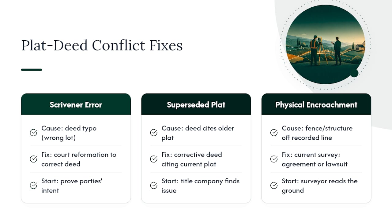
The first is a scrivener's error: a deed cites "Lot 12" when the plat and the actual transaction clearly intended "Lot 21." Courts typically resolve this through reformation, correcting the written instrument to match the parties' documented intent, once the error is proven.
The second is a superseded plat. A tract gets platted, then re-platted years later with different lot lines, but an old deed still references the original plat book and page. Title companies catch this during a title search, and the fix usually involves a corrective deed that cites the current, controlling plat.
The third, and most common in practice, is a fence or structure that doesn't match either document. A previous owner built a fence based on where they assumed the line was, not where the recorded plat or a survey actually places it. Neither the deed nor the plat is "wrong" here. The problem is that nobody ever verified the fence against either one. A current survey typically resolves this quickly by showing exactly how far off the physical marker sits, which then opens the door to either a boundary line agreement or, if the encroachment is significant, a legal claim.
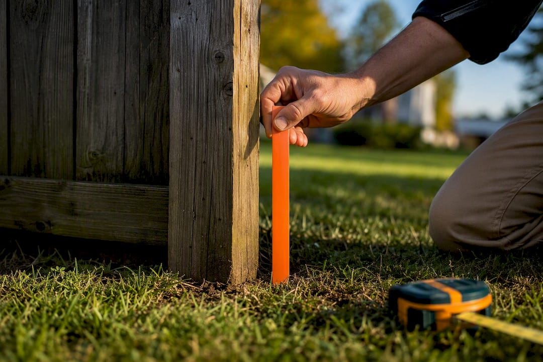
In every case, the fix starts with the same step: get a licensed surveyor's current read on the ground before assuming either paper record is correct.
Plats, Deeds, and the Subdivision Approval Process
Before a developer can sell individual lots, the raw tract typically has to go through a subdivision approval process, and the plat is the document that formalizes the outcome. Local planning departments review a proposed plat against zoning, infrastructure capacity, and dedication requirements before granting approval and allowing it to be recorded.
That approval process is where a lot of future deed language actually gets decided. Setbacks, easement locations, street dedications, and even stormwater requirements get baked into the plat during review, and every deed for every lot in that subdivision inherits those terms whether the buyer reads the plat or not. Skipping careful review at this stage, or misjudging how a jurisdiction will interpret density or infrastructure requirements, is exactly the kind of costly mistake a feasibility review is designed to catch before it becomes a recorded, binding obligation.
Developers who treat the plat approval process as a formality rather than a negotiation tend to end up with lot configurations that are harder to sell, easements in inconvenient places, or infrastructure costs they didn't anticipate. Getting the plat right at the subdivision stage saves every subsequent deed from inheriting a problem.
How Plats and Deeds Shape Property Taxes and Public Records
County assessors use recorded plats and deeds together to build the legal descriptions that show up on every property tax bill. A parcel's tax record typically cites the same lot-and-block reference the deed uses, pulled straight from the recorded plat, which is why an outdated or unrecorded parcel split can cause tax assessments to lag behind the actual property configuration.
This matters in two practical ways. First, when a parcel is split or combined but the new plat isn't recorded promptly, the tax rolls may keep billing under the old configuration, creating confusion over who owes what on which piece. Second, easements and dedications shown on a plat, like a strip given to the county for a road, are usually removed from the taxable acreage, which can quietly lower a parcel's assessed value once the county catches up to the recording.
Public records searches, whether through a county Register of Deeds, GIS portal, or tax assessor's office, rely on this linkage constantly. A title search pulls the deed chain; a boundary check pulls the plat; the tax record ties both back to a parcel number. When any one of those three falls out of sync with the others, it's usually the plat and deed recording that needs to catch up, not the tax record that's necessarily wrong.
The Practical Take: Stop Treating Records as Proof of Reality
The biggest mistake homeowners and even some developers make is treating a deed or an old plat as settled fact rather than a paper description that may or may not match the ground anymore. A deed proves you have a legal claim to a parcel. It does not prove where that parcel's corners actually sit, and conventional advice that tells buyers "just check the deed" skips the part that actually causes disputes.
The research bears this out consistently: when written records and physical monuments disagree, surveyors' current field work tends to win, not the older paperwork. That should reorder your priorities. Before you build near a line, subdivide a tract, or take on financing that hinges on exact boundaries, a licensed survey isn't a formality. It's the only document that tells you what's actually true today, as opposed to what was true, or assumed, when the last deed was recorded.
Land planning firms that catch platting and boundary conflicts during feasibility review, rather than after a lender or buyer discovers them, save clients real time and money. That's the gap between what a deed search promises and what a site actually needs before development moves forward. Coordinating survey work through a firm like Amauta Public Affairs on the public-affairs side, alongside your own land planning consultant, tends to catch conflicts earlier than waiting for a title company to flag them during closing.
If you're weighing whether to buy, subdivide, or develop a parcel where the paperwork looks even slightly inconsistent, a feasibility study that reviews your deed, plat history, and zoning together is worth more than another round of guessing. Urban Planning Pros builds that review around actual document evaluation, not assumptions, and coordinates the survey work when boundaries need a current, defensible answer before you commit capital.
— Jeremy Wenger
Sources
- Deed vs Title: What's the difference? | Experian
- Do I need a survey or plat to transfer land by deed? (Pierce Law)
- Deed — Cornell Legal Information Institute
FAQ
Is a Deed More Important Than a Title?
They're not competitors; a deed is the document, and title is the legal right the deed conveys. You need a valid, recorded deed to establish clear title, so think of the deed as evidence and title as the outcome it proves.
Is a Plat a Legal Document?
Yes. A recorded plat is a legal document once approved and filed with the county, and it carries binding authority over lot lines, easements, and dedications for every future owner in that subdivision.
Is a Plat Map Legally Binding?
A recorded plat map is legally binding on the property once filed, meaning easements, setbacks, and dedications shown on it apply to current and future owners even if a later deed doesn't repeat them.
How Do I Get a Copy of My Land Plat?
Recorded plats are typically available through the county Register of Deeds, recorder's office, or an online GIS/tax portal by searching your address, owner name, or the plat book and page number cited on your deed.