
A site constraints analysis is a due-diligence review that identifies every legal, physical, and infrastructure limit on a parcel, from zoning and easements to utility capacity and permitting risk, before you close, sell, or break ground. It exists to answer one question: what can this land actually become, and at what cost and timeline? Skip it, and you're pricing land on hope instead of facts. Entitlement costs alone can represent roughly 40% of multifamily development costs, which is why firms like Urban Planning Pros build entire feasibility practices around finding these limits before contracts get signed.
TL;DR:
- Entitlement timing and costs are the most influential factors, with approvals taking 3 to 18 months and regulations adding up to 40% of development costs.
- Missing environmental, easement, or utility constraints can significantly reduce usable acreage and increase project costs if not identified early.
- A comprehensive site constraints analysis must include zoning, environmental, title, easements, and infrastructure reviews, integrated into a single evaluation.
- Relying solely on gross acreage overstates buildable land, risking overpayment and mispricing, especially if entitlement uncertainty is not accounted for.
- Engaging specialists is crucial when rezoning, variances, or environmental issues are involved, ensuring analysis includes official opinions, utility confirmation, and yield calculations.
Table of Contents
- What Does a Site Constraints Analysis Cover?
- How to Perform a Site Constraints Analysis: Steps and Deliverables
- Which Constraints Move the Underwriting Numbers Most?
- Ten Questions and Red Flags That Should Change Your Offer
- When to Bring in a Specialist
- GIS Mapping, Surveys, and Other Tools That Do the Work
- What Real Deals Teach About Constraint Impacts
- Folding Environmental and Geotechnical Findings Into the Analysis
- Who Needs to Be at the Table During the Review
- Get a Constraints Analysis Before You Sign Anything
- Underwriting Mistakes That Keep Showing Up
- Sources
- FAQ
What Does a Site Constraints Analysis Cover?
A complete review checks five categories, and missing any one of them is how deals go sideways after closing.
- Zoning and allowable uses. This means confirming the base district, any overlay zones, setback and height standards, and whether your intended use is permitted outright or requires a variance.
- Entitlement path. You need to know whether the project qualifies as by-right or requires discretionary approval, and whether any prior approvals are still vested or have quietly expired.
- Title, easements, and covenants. Recorded restrictions, utility easements, and deed covenants can shrink usable acreage well below what the tax parcel map suggests.
- Environmental indicators. Wetlands delineations, flood zone status, and any flags suggesting prior contamination need to surface early, not during closing week.
- Utilities and infrastructure capacity. Water, sewer, and road access determine whether the site can support your program without expensive off-site work.
These five categories interact. A parcel with clean zoning but no sewer capacity is functionally as constrained as one with utilities but a wetlands problem. Treat the review as one integrated evaluation, not five separate checkboxes.
How to Perform a Site Constraints Analysis: Steps and Deliverables
A disciplined process runs in a specific order, because each step either confirms or eliminates the need for the next.
- Pull records and review the survey. Start with a title report, the recorded plat, and any prior approvals or permits tied to the parcel.
- Draft a zoning memo. Identify the base district, overlays, and specifically whether your use triggers a discretionary review under the local entitlement and zoning approval process.
- Request utility availability letters. Water and sewer providers will confirm existing capacity in writing, which is far cheaper than discovering a deficiency later.
- Flag high-level traffic, school, and fire implications. These rarely kill a deal alone, but they shape conditions of approval and can add months to a discretionary process.
- Run an environmental screen. Check for wetlands, flood zone designation, and any indicators that would trigger a Phase I assessment, alongside a basic geotechnical review of soil conditions.
- Calculate concept yield. Convert gross acreage to net buildable acreage after setbacks, easements, and environmental exclusions, then estimate a realistic unit or square footage count.
- Build a contingency estimate. Attach a time and cost range to the unresolved items, weighted by how likely each is to become a real obstacle.
The output should be a written constraints memo, GIS overlays showing every limit spatially, a concept yield calculation, and a short list of recommended next steps. If a consultant hands you anything less, you haven't bought a real analysis. This process mirrors the broader discipline of market analysis used in feasibility work, where regulatory findings get synthesized with financial and demand data rather than reviewed in isolation.
Which Constraints Move the Underwriting Numbers Most?
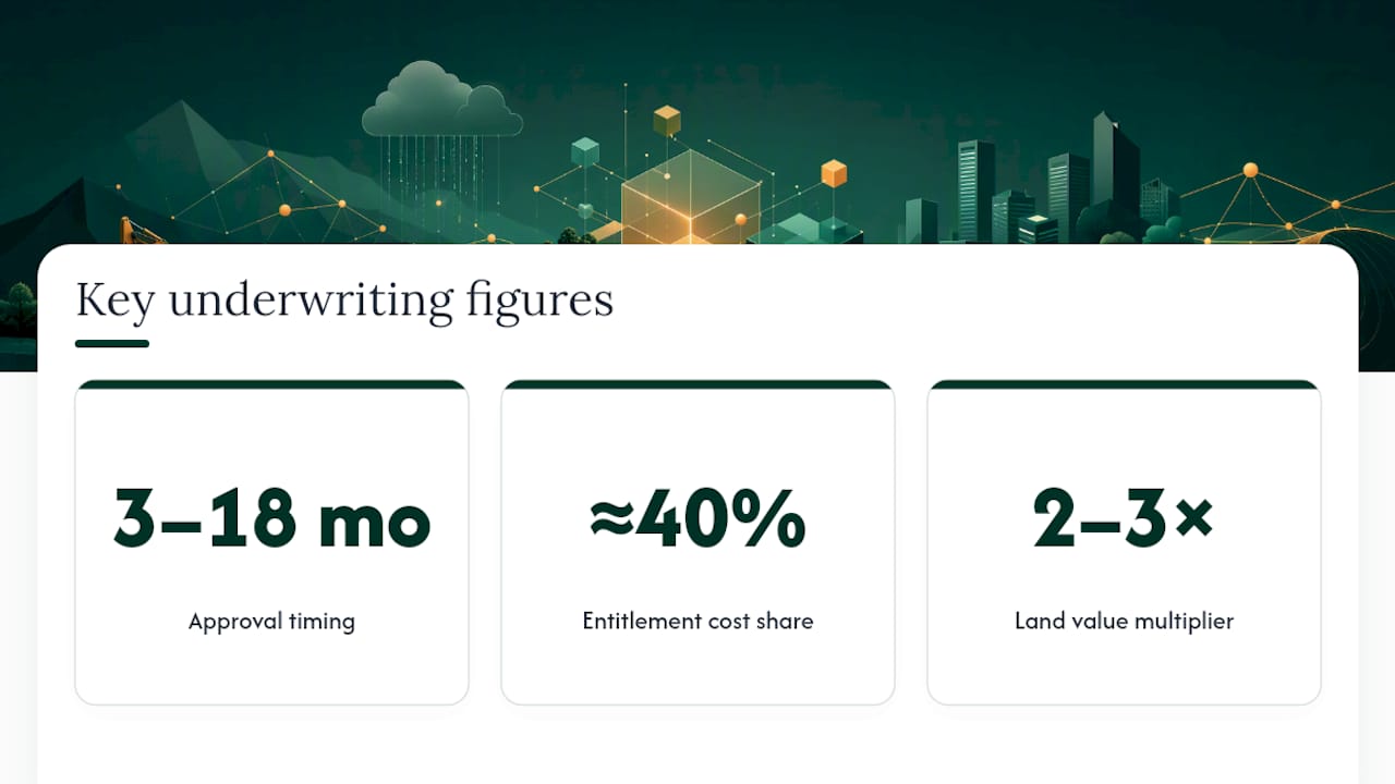
Entitlement timing and cost are the two variables that swing a deal's return more than any other constraint category. Approvals commonly take between 3 and 18 months, and entitlement-related regulatory costs represent close to 40% of total multifamily development costs according to NAHB's analysis. Securing entitlements can also multiply raw land value by two to three times, which is exactly why a buyer who prices a parcel before confirming its entitlement path is gambling on an uncertain figure that could move dramatically in either direction.
Gating items carry their own cost profiles. A required sewer upgrade or a remediation trigger can add real time and real dollars, and those figures vary too widely by jurisdiction to generalize, but they need a line item in your model regardless. Usable acreage loss compounds the problem quietly: a 40-acre parcel that nets to 28 buildable acres after wetlands and easements doesn't just lose 12 acres of dirt, it loses the units, the absorption, and the exit value tied to that dirt. Buyers who underwrite off gross acreage instead of net buildable acreage routinely overpay, since entitlement certainty functions as a value multiplier that gross-acreage pricing ignores entirely. Price the uncertainty into your offer, not just the acreage.
Ten Questions and Red Flags That Should Change Your Offer
Before you sign anything, ask the seller and the municipal planning staff these questions directly:
- What is the current zoning designation, and does it match your intended use by right?
- Are there active or expired discretionary approvals tied to this parcel?
- What off-site improvements were required under any prior approval, and were they completed?
- Do recorded easements or covenants restrict building footprint or access?
- What is the current water and sewer capacity, confirmed in writing by the utility provider?
- Is any portion of the site within a mapped wetland, floodplain, or environmental overlay?
- Has a Phase I environmental assessment ever been performed on this parcel?
- What geotechnical conditions are known, and has a soils report been completed?
- What is the anticipated approval path: by-right, or discretionary requiring public hearings?
- Are there pending moratoriums, infrastructure caps, or political sensitivities in this jurisdiction?
Watch for these red flags in particular: expired vesting on a "previously approved" project, unresolved off-site obligations that a seller failed to complete, or utility letters that hedge on capacity instead of confirming it outright. Any of these should adjust your price, not just your risk notes.
Size your contingencies by approval path. By-right projects can often move in a matter of months, while discretionary approvals commonly add many months to years and introduce genuine political risk, per Clear House Lending's entitlement guide.
Pro Tip: Negotiate a due-diligence period tied to specific milestones, not just a flat number of days. A 90-day contingency that survives a slow utility provider's response time protects you far better than a 60-day clock that expires before your zoning memo is even finished.
When to Bring in a Specialist
Complexity and political sensitivity are the two triggers that should push you toward hiring outside expertise. A straightforward by-right infill lot rarely needs a full team. A parcel requiring rezoning, a variance, or a public hearing in a jurisdiction you don't know well is a different situation entirely.
At minimum, a qualified consultant scope should include a written zoning opinion, a utility capacity check with documentation, a full constraints memo, and a concept yield calculation. Anything short of those four deliverables leaves gaps in your underwriting.
Urban Planning Pros builds this scope around comprehensive feasibility studies and master land planning, evaluating property documents, zoning constraints, and market direction together rather than as separate exercises. That integrated approach is what catches the interactions between constraint categories, like a zoning win undercut by an infrastructure gap, before they become expensive surprises mid-project. Project snapshots on the portfolio page show how these reviews have shaped real acquisition and planning decisions.
GIS Mapping, Surveys, and Other Tools That Do the Work
Modern constraints analysis leans heavily on GIS mapping to layer zoning boundaries, flood zones, wetlands, and utility infrastructure onto a single spatial view of the parcel. This matters because constraints rarely respect property lines cleanly. A wetland boundary might clip the northeast corner of a site while an easement runs diagonally across the middle, and only a layered map shows how those two limits interact to squeeze buildable area.

Boundary and topographic surveys remain the ground-truth check against any GIS layer, since public GIS data can lag behind actual recorded conditions by months or years. A licensed survey confirms exact property lines, existing easements, and physical features like grade changes that affect buildability. Urban Planning Pros pairs GPS/GIS mapping services with survey and engineering coordination specifically because neither tool alone tells the full story.
Title searches and municipal record pulls round out the toolkit, surfacing covenants, prior approvals, and recorded restrictions that no map will show. For utility capacity specifically, direct availability letters from water and sewer providers beat any published infrastructure map, since capacity changes as nearby development draws down existing systems. Engineering firms increasingly flag MEP and infrastructure constraints early in mixed-use feasibility work for the same reason: capacity on paper and capacity in practice are not always the same number. The right toolset combines spatial mapping, physical survey verification, and direct utility confirmation, not any single method in isolation.
What Real Deals Teach About Constraint Impacts
A parcel that looks clean on a zoning map can still carry limits that only surface once someone checks the recorded documents. Consider a common scenario: a 15-acre site zoned correctly for a planned use, but with a 3-acre drainage easement running through the middle that was never reflected in the marketing materials.
Infrastructure gaps tell a similar story. A site with adequate zoning and no environmental flags can still stall for a year or more if the nearest sewer main lacks capacity for the proposed density, and the developer discovers this only after committing to a purchase price built on the original unit count. Impact fees and required off-site upgrades in these situations vary widely by jurisdiction, but they consistently show up as gating items that reshape project economics when they're caught late instead of early.
Expired vesting is another recurring pattern. A parcel marketed as "previously approved for 200 units" can turn out to have an entitlement that lapsed three years earlier, meaning the buyer is actually purchasing raw, unentitled land at an entitled-land price. Each of these examples shares a common thread: the constraint existed in public or recorded documents the entire time. A structured site constraints analysis is what surfaces it before the purchase, not after.
Folding Environmental and Geotechnical Findings Into the Analysis
Environmental and geotechnical findings need to feed directly into the concept yield and cost model, not sit in a separate report that nobody references again. A wetlands delineation that removes three acres from the buildable footprint has to flow into the same yield calculation as the zoning setbacks, because a buyer or lender needs one net number, not three conflicting acreage figures from three different consultants.

Environmental screening, utility capacity, and zoning checks belong together in early feasibility work precisely because these three issues most commonly kill or delay deals when they surface separately and late. A Phase I environmental assessment that flags a potential contamination source should immediately adjust the project's contingency budget and timeline, not wait for a separate remediation study to circle back weeks later.
Geotechnical conditions carry the same integration requirement. Poor soil bearing capacity can force a foundation redesign that changes unit costs across an entire multifamily program, and that cost shift needs to appear in the same underwriting model as the entitlement timeline, not in a standalone engineering memo. Environmental remediation itself is worth flagging as its own category of gating item. Radon mitigation, for instance, is a common and specific environmental condition that affects real estate transactions in certain markets and needs its own line item in a contingency budget rather than a vague "environmental allowance."
The practical rule: every environmental and geotechnical finding should have a dollar figure and a timeline impact attached before it enters the final feasibility memo. A finding without a quantified impact is just a flag, not an input.
Who Needs to Be at the Table During the Review
A site constraints analysis works best as a coordinated conversation, not a single consultant working in isolation. Municipal planning staff hold the zoning interpretation authority, and a pre-application meeting with them often surfaces discretionary triggers or political sensitivities that no public document will show. Utility providers need to be contacted directly rather than relying on published capacity maps, since actual availability shifts as nearby projects draw down shared infrastructure.
Surveyors and engineers confirm the physical realities, easements, topography, and soil conditions, that a zoning memo alone can't capture. Environmental consultants weigh in when a Phase I assessment or wetlands delineation is warranted. And the landowner or seller needs to be pushed for documentation on prior approvals, off-site obligations, and any recorded restrictions they may not volunteer proactively.
Communication among these parties needs to happen in a specific sequence. Zoning findings should reach the engineer before the concept yield gets calculated, and environmental flags should reach the underwriting team before a final offer price gets set, not after. A constraints memo that consolidates input from all these stakeholders into one document, with one net buildable acreage figure and one contingency estimate, is what actually gets used in a purchase decision. A stack of five disconnected reports from five specialists rarely does.
Get a Constraints Analysis Before You Sign Anything
Urban Planning Pros scopes exactly this kind of review through its feasibility studies practice, combining zoning research, entitlement strategy, and concept yield work into one coordinated engagement instead of a stack of disconnected reports. That coordination is the practical advantage over piecing together separate consultants yourself: one team tracks how a zoning finding, a utility gap, and an easement interact, rather than leaving you to reconcile three conflicting memos on your own timeline.

For a parcel you're evaluating right now, the Commercial Site Feasibility Snapshot is built as a rapid buy or no-buy product, sized for exactly the acquisition window where you need answers before a contingency period expires. Land planning services extend from there into master planning and entitlement strategy for landowners ready to move past initial diligence into execution. If you're weighing an offer on a parcel with unresolved zoning or utility questions, reach out for a scoped quote on a feasibility engagement before your due-diligence clock runs out.
Underwriting Mistakes That Keep Showing Up
The most expensive mistake in land acquisition is pricing off gross acreage instead of net buildable acreage. Buyers see 40 acres, model 40 acres of value, and only discover the easements and wetlands after closing, when the number that actually matters has already shrunk.
The second mistake is treating off-site obligations as someone else's problem. A prior approval that required road improvements or utility extensions doesn't disappear when the property changes hands. It transfers, and lenders increasingly expect underwriting models to reflect that transferred liability upfront.
One practical fix: build your initial pricing model on a deliberately conservative net acreage figure, then adjust upward only after title and survey confirm the real number. It's a small discipline that prevents the largest and most common underwriting error in the business.
— Jeremy Wenger
Sources
- NAHB special study: regulation share of multifamily development costs (2018)
- How to do a market analysis (university guidance on feasibility components)
FAQ
What Is a Site Constraints Analysis?
It's a due-diligence review that identifies legal, physical, and infrastructure limits on a parcel, including zoning, easements, entitlements, and utility capacity, to determine what can realistically be built and at what cost.
How Long Does Entitlement Approval Typically Take?
Entitlement and zoning approvals commonly take between 3 and 18 months, depending heavily on whether the project qualifies as by-right or requires discretionary review.
What Percentage of Development Costs Come From Entitlement and Regulation?
Regulatory and entitlement-related costs represent roughly 40% of total multifamily development costs according to NAHB's research.
What Are the Most Common Deal-Killing Constraints?
Environmental issues, zoning mismatches, and infrastructure capacity gaps are the three constraint categories that most frequently kill or delay deals when they surface late in the process.
Should I Hire a Consultant or Do the Analysis Myself?
Straightforward by-right sites often don't require outside help, but parcels needing rezoning, variances, or public hearings benefit from a specialist like Urban Planning Pros, whose feasibility study scope covers zoning opinions, utility checks, and concept yield calculations in one coordinated engagement.