
A topographic survey gives your design team the terrain, elevation, and feature data that everything else depends on: grading plans, drainage design, earthworks volumes, permit exhibits, and construction cost estimates. It produces design-ready contours, a digital terrain model, and coordinated feature lines your engineers can build on immediately. The payoff is concrete: less earthwork uncertainty, cleaner drainage solutions, faster permit review, and fewer change orders once construction starts.
TL;DR:
- Most topographic surveys should produce clean DWG files, accuracy reports, and detailed feature data to ensure reliable integration into design software.
- A hybrid survey approach combining UAV, GNSS, and total station methods offers the best balance of speed and precision, especially on varied terrain or vegetated sites.
- Conducting early and accurate surveys prevents costly redesigns, change orders, and delays during permitting and construction phases.
- Costs and timelines increase with site size, feature density, and terrain complexity, making detailed scope definition essential for accurate bids.
- Survey data quality and completeness directly impact project feasibility, earthwork calculations, utility coordination, and permit approval processes.
Table of Contents
- What a Topographic Survey for Development Includes
- GNSS, Total Station, UAV, or LiDAR: Choosing the Right Method
- From Survey Data to Design Decisions
- When to Order Your Survey and What It Costs to Run
- How to Write an RFQ Surveyors Can Actually Bid On
- Where Topo Data Fits Into Urban Planning Pros' Feasibility Work
- Where Projects Actually Go Wrong
- Get Your Site Assessed Before You Commit to a Design Direction
- Sources
- FAQ
What a Topographic Survey for Development Includes
A topographic survey maps the natural and man-made features of a site in three dimensions, capturing elevation, grade, structures, utilities, and vegetation into one coordinated dataset. For any topographic survey development project, the survey package needs to arrive in formats your engineers can drop straight into design software, not a static PDF.
Ask your surveyor for these deliverables up front:
- DWG file for direct CAD integration with your engineering and architectural drawings
- Digital terrain model (DTM) or TIN surface showing continuous ground elevation
- Contour lines at a stated interval, matched to your site's grade and design precision needs
- Coordinated point list (CSV) for every surveyed feature and elevation shot
- Orthomosaic or DEM if the work was flown, giving you an aerial base image tied to real coordinates
- Accuracy statement and control report documenting how the survey ties to known benchmarks
Pro Tip: Request a sample deliverable set before you sign a contract. A surveyor who cannot produce a clean DWG and accuracy report on request is not one you want holding your project timeline.
Federal guidance on detailed topographic surveys, including USACE's Engineer Manual EM 1110-1-1005, calls for clearly documented control points, appropriate map scales, and a stated contour interval, along with horizontal and vertical control tied to a recognized reference system. That's the standard your bid should meet, whether you're building a single pad site or a multiphase subdivision.
GNSS, Total Station, UAV, or LiDAR: Choosing the Right Method
Every capture method trades speed for precision differently, and the right choice depends on your site's terrain, obstructions, and required accuracy.
- GNSS/RTK works fast on open sites with clear sky visibility, typically delivering 1 to 10 centimeters of accuracy for detail surveys. It struggles under tree canopy, near tall buildings, or in dense urban corridors where satellite signals bounce or drop out.
- Total station surveying handles those obstructed conditions well. It's slower per point but delivers high precision for retaining walls, building corners, and utility structures in tight urban sites.
- UAV photogrammetry covers large acreage quickly, but survey-grade accuracy depends on ground control points tied into the flight. Without them, you get a good-looking map with unreliable elevations.
- Terrestrial LiDAR captures extremely dense point clouds for complex features like retaining structures, bridges, or industrial sites where every surface detail matters.
Most development projects don't rely on a single method. A hybrid approach, drone capture for broad coverage, GNSS for ground control, and targeted total-station pickups for utility inverts and structures, gets you speed and precision together. This kind of layered workflow is increasingly standard for property development surveys, especially on sites where the terrain or vegetation varies across the parcel. Learn more about how 3D laser scanning services fit into this mix when a site demands extreme feature detail.
Pro Tip: If your site has any dense canopy or buried utilities, don't rely on drone photogrammetry alone. Pair it with ground-based pickups for anything underground or obscured. Aerial data has real limits here.

From Survey Data to Design Decisions
Topographic data doesn't just document a site. It answers the specific engineering questions that shape your project's cost and timeline.
- Grading and site layout. The DTM and contour set let your civil engineer test building pad elevations, slope percentages, and cut-and-fill balance before a single stake goes in the ground.
- Drainage routing. Accurate elevation data reveals where stormwater naturally wants to go, letting your team design detention basins, swales, and pipe networks that actually work with the terrain instead of fighting it.
- Earthworks volumes. Once you have a reliable existing-conditions surface, your engineer can calculate cut and fill quantities early, which means your cost estimate reflects reality instead of a rough guess.
- Utility coordination. Feature mapping that includes invert elevations and existing utility locations cuts down on requests for information during design, because your engineers already know what's there.
- Permitting exhibits. Jurisdictions reviewing grading and drainage permits want to see accurate existing conditions. A clean topo survey speeds that review because reviewers aren't stuck guessing at your baseline data.
Skipping or rushing this step is one of the more common reasons projects hit redesign cycles. Accurate, early site data consistently reduces the kind of rework that eats budget and schedule on development projects.
When to Order Your Survey and What It Costs to Run
Order your topographic survey during due diligence, before you commit capital to a purchase, or immediately before design begins if you already own the parcel. If site conditions have changed since your original survey, whether from grading, demolition, or a storm event, get a fresh one before construction starts. Building on outdated topo data is how change orders happen.
Timeline expectations vary by method and acreage:
- A small residential lot surveyed with a total station typically takes 1 to 2 days in the field.
- A 5-acre site with a total station runs similarly, around 1 to 2 days field time.
- A 50-acre site or larger UAV-based survey can need 3 to 5 days in the field and up to 5 to 10 days of processing to deliver a finished dataset.
Cost drivers stack in a predictable order: total acreage, feature density (how much is on the ground to map), required accuracy, the deliverables you request, and site access. Dense vegetation, steep terrain, or a jurisdiction requiring specific permit-ready exhibits will all push the price and timeline up.
How to Write an RFQ Surveyors Can Actually Bid On
A vague scope gets you vague, incomparable bids. A tight, specific brief gets you pricing you can actually evaluate side by side.
- Define your coordinate system and datum. State the horizontal and vertical reference you need, tied to a recognized system such as the National Spatial Reference System, so the survey integrates cleanly with your civil design.
- Attach a site map with rough boundaries and flag any known constraints, easements, or utility corridors.
- List every feature category you need captured, including trees, structures, pavement edges, and existing utilities.
- Specify your contour interval and required accuracy tolerance, in both horizontal and vertical terms.
- Name the exact file formats you need delivered, and require an accuracy or closure report with the final package.
On the contract side, nail down the timeline, what happens if a resurvey is needed, who's liable for capture errors, and what a formal deliverable sign-off looks like. Before you award the work, ask each bidder directly: what control network will you establish, how will you locate buried utilities, and what QA documentation comes with the final files? A clear, specific scope is still the single best way to get bids you can actually compare.
Pro Tip: Bidders who hesitate to answer your utility-location question directly are telling you something. Get specifics before you sign, not after the invoice arrives.
For readers building out a broader cost plan alongside the survey scope, this construction cost plan checklist walks through how measurement and cost estimating tie together on a live project.
Where Topo Data Fits Into Urban Planning Pros' Feasibility Work
Urban Planning Pros treats topographic data as a foundation layer for feasibility work, not an afterthought filed away after the fact. Zoning checks, grading concepts, and entitlement constraints all get evaluated against the actual terrain, not an assumed flat pad.
That integration runs across several service lines:
- Survey coordination, managing the field work and reviewing deliverables against your project's accuracy needs
- Feasibility studies, using survey data to test what a site can realistically support
- Master land planning, translating terrain and constraints into a workable site concept
- GPS/GIS mapping, building the control network your design team relies on
Bringing this expertise in early, before you're locked into a site plan built on assumptions, is how landowners and developers avoid discovering a grading problem after the entitlement clock has already started running.
Where Projects Actually Go Wrong
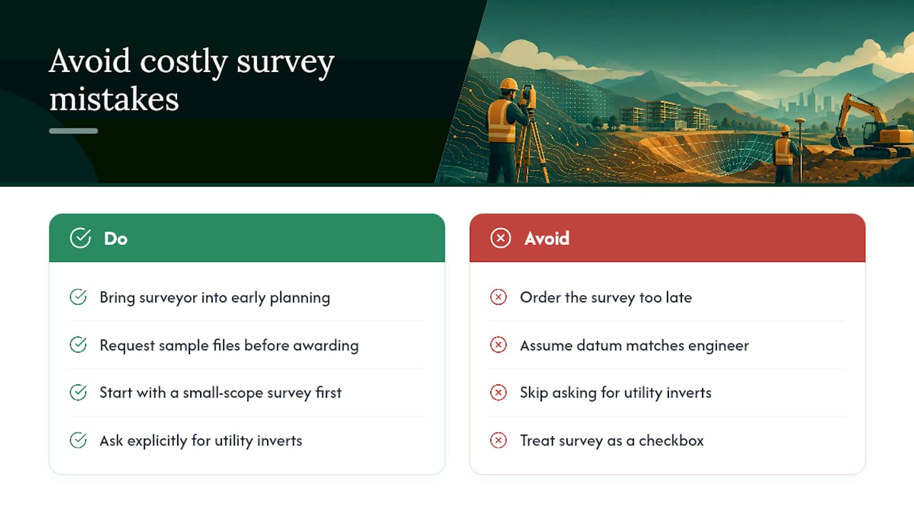
The pitfalls I see repeat themselves across projects: a survey ordered too late in the process, a datum that doesn't match what the civil engineer assumed, or a feature list that skipped utility inverts because nobody asked for them explicitly. None of these are exotic mistakes. They're basic scoping failures that show up in the final design as costly surprises.
Two things fix most of this. Bring your surveyor into the preliminary planning conversation instead of treating the survey as a box to check after design decisions are already made. And request sample files before you award the contract, not after. If a small-scope survey is enough to answer your first round of feasibility questions, start there. It's a low-cost way to de-risk the decisions that come next.
— Jeremy Wenger
Get Your Site Assessed Before You Commit to a Design Direction
Some firms give landowners and developers a single point of coordination for the survey, feasibility, and planning work that usually gets handled by multiple disconnected vendors, which can reduce handoff errors and speed the path from raw site data to a workable concept.

If you're weighing a purchase, planning a subdivision, or trying to figure out what a parcel can actually support, gather your parcel ID, any existing site imagery, and a plain-language statement of your project goals before reaching out. That's enough to scope a feasibility study that connects directly to your survey needs. Start with a feasibility study to see what your site can support before you spend another dollar on design.
Sources
- Use of GNSS in land surveying and mapping — RICS (3rd edition)
- EM 1110-1-1005 — Topographic surveys (USACE)
- What Developers Need to Know About Topographic Surveys — Challenger Geomatics
- What Is a Topographic Survey? — Civil Engineering Guide | NKMPV
FAQ
Do I need a topographic survey to build a house?
Most jurisdictions require one for permit review, especially where grading, drainage, or septic design is involved, and your civil engineer needs the elevation data regardless of whether the permit office asks for it.
What is included in a topographic survey?
A standard package includes a DWG file, a digital terrain model, contour lines at a stated interval, a coordinated point list, and an accuracy or control report tied to a recognized datum.
What is the difference between a boundary survey and a topographic survey?
A boundary survey establishes legal property lines and corners, while a topographic survey maps elevation, terrain, and physical features across the site, and development projects typically need both.
How long does a topo survey take?
A small lot with a total station usually takes 1 to 2 days in the field, while a larger UAV-based survey on 10 to 50 acres can run several days of flight time plus up to 10 days of processing before final deliverables are ready.