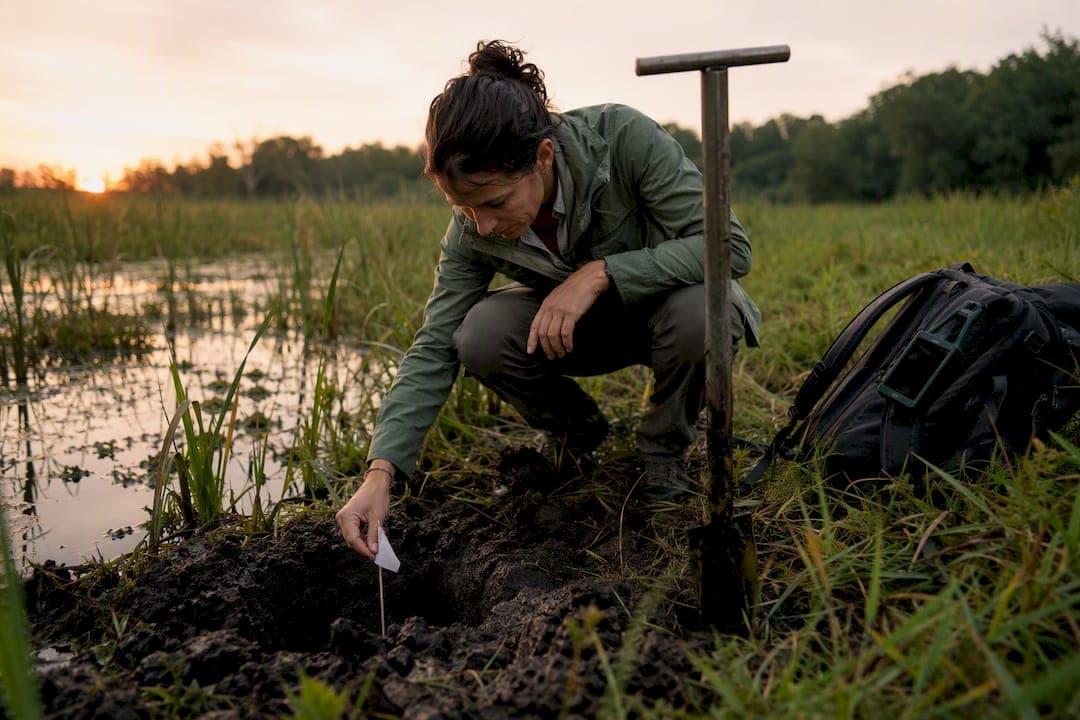
A wetland delineation is the technical process of mapping wetland boundaries on a property by evaluating three mandatory parameters: hydrophytic vegetation, hydric soils, and wetland hydrology. The output is a boundary map and a technical report you can use for site planning or agency submittal. Most projects need one before design starts, with agency verification, or a Jurisdictional Determination, as a follow-up step once permitting is on the table.
TL;DR:
- A wetland delineation requires evaluating vegetation, soils, and hydrology at sample points, with boundary accuracy influenced by GPS quality and field conditions.
- Agency-approved Jurisdictional Determinations take roughly 90 days or more, significantly extending project timelines compared to private delineations.
- Hiring a qualified ecologist with experience in the USACE manual and regional supplements ensures more reliable boundaries and stronger agency review defense.
- Conducting the delineation early as part of feasibility avoids costly redesigns and helps accurately determine buildable land before site development.
- Combining delineation, mapping, and feasibility work into one integrated process saves time and provides data directly usable for site planning and permitting.
Table of Contents
- What a Wetland Delineation Is and When You Need One
- Step-by-Step Wetland Delineation Process: Office and Field Workflow
- Typical Timeline and Cost Factors
- Delineation vs. Jurisdictional Determination: What's the Difference?
- How to Choose and Work With a Qualified Wetland Delineation Consultant
- Report Deliverables, Maps, and Data You Should Receive
- Practitioner Perspective: Why Early Delineation Matters for Feasibility
- Explanation of Delineation Boundaries and How They Are Established
- Tips for Ensuring Compliance to Avoid Regulatory Penalties
- Common Challenges During the Delineation Process and How to Address Them
- Overview of Relevant Regulations and Permitting Requirements
- Examples of Field Data Collection Techniques and Tools Used
- Why Treating Delineation as a Scheduling Tool Beats Treating It as a Compliance Checkbox
- Let Urban Planning Pros Handle Your Wetland Delineation and Feasibility Work
- Sources
What a Wetland Delineation Is and When You Need One
A delineation exists to answer one question with legal weight: does a regulated wetland sit on this property; if so, where exactly does it start and stop? The federal standard comes from the 1987 USACE Wetland Delineation Manual, which sets the technical criteria every consultant uses regardless of state.
You generally need one for:
- Permitting, since most Section 404 and state wetland permits require a delineated boundary before an agency will act.
- Pre-purchase due diligence, so you know before closing whether buildable acreage is smaller than the deed suggests.
- Subdivision or site layout, where lot lines, roads, and stormwater infrastructure have to avoid regulated areas.
A technical delineation alone is often enough for internal planning, budgeting, and layout decisions. Once you're ready to submit a permit application or need certainty before closing on land, request USACE verification or a formal Jurisdictional Determination, covered in more detail below.
Step-by-Step Wetland Delineation Process: Office and Field Workflow
The workflow follows a predictable sequence, and knowing it helps you evaluate a consultant's proposal instead of taking their word for it.
- Resource review. The consultant pulls the National Wetlands Inventory, county soil surveys, historical aerial imagery, and any prior permit history on the parcel before ever setting foot on-site. This desktop pass flags likely wetland zones and shapes where field crews will focus.
- Field reconnaissance and transect placement. Crews walk the property and set transects or sample plots across representative topography, typically moving from upland to lowland to capture the transition zone where the boundary actually falls.
- Vegetation sampling. At each plot, the crew records dominant plant species by stratum (tree, shrub, herb) and checks them against regional wetland plant indicator lists to determine whether the community qualifies as hydrophytic.
- Soil pits and augering. A shovel or hand auger opens a pit at each plot, and the crew checks for NRCS hydric soil indicators like low chroma, redox concentrations, or organic accumulation.
- Hydrology indicators. The crew looks for saturation, surface water, drainage patterns, and other primary or secondary signs of wetland hydrology at the same depth as the soil pit.
- GPS flagging and data forms. Every plot gets a coordinate and a standardized data sheet documenting the vegetation, soil, and hydrology findings side by side.
- Decision logic. If all three parameters are met at a plot, it's wetland; if any one clearly fails, it's upland. Most sites qualify for the routine approach; comprehensive, quantitative sampling gets reserved for complex or contested sites where litigation risk is higher.
- Mapping and reporting. The flagged points become a GIS shapefile, the boundary gets drawn, and a narrative report documents methods, findings, and justification for every call made in the field.
Pro Tip: Ask your consultant upfront whether they're using the routine or comprehensive procedure. Routine is faster and cheaper, but a site with ambiguous vegetation or disturbed soils may need the comprehensive method to hold up under agency scrutiny later.
Typical Timeline and Cost Factors
Field time ranges from a short period on a small, straightforward parcel to several weeks on large or ecologically complex sites. Report preparation and mapping typically add additional time on top of field work.
If you go on to request agency verification, USACE district review timelines can add several months depending on workload and site specifics. That review gap is often the single biggest scheduling risk on a development timeline, more than the fieldwork itself.
Cost drivers include:
- Acreage and habitat complexity, since dense, mixed vegetation communities take longer to classify than open fields.
- Season, because vegetation is hardest to read outside the growing season, and some indicators disappear in winter.
- Site access, with difficult terrain or limited entry points slowing crews down.
- Deliverable precision, since survey-grade GPS mapping costs more than a standard handheld unit.
There's no uniform national fee schedule for this work, so budget assumptions should come from a scoped proposal, not a rule of thumb.
Delineation vs. Jurisdictional Determination: What's the Difference?
A technical delineation is a consultant's professional finding. A Jurisdictional Determination is USACE's regulatory confirmation of that finding under Section 404 of the Clean Water Act, and it carries legal weight that a private report doesn't.
Many landowners commission a delineation first purely to inform site design, then request a JD only once a permit application is actually needed. That sequencing saves money if the project changes direction before permitting starts.
- Request a JD when you need certainty before finalizing a purchase, permit, or financing decision.
- Consider Corps Delineation Concurrence as a lighter-weight alternative some USACE districts offer in place of a full JD.
- Expect added time, since a parcel JD can take roughly 90 days in some state processes, and federal review can run longer.
The trade-off is straightforward: a JD buys certainty at the cost of schedule, while relying on the technical delineation alone keeps you moving faster but carries more risk if the agency later disagrees.
How to Choose and Work With a Qualified Wetland Delineation Consultant
Not every environmental consultant is qualified to delineate wetlands for regulatory purposes. Look for a wetland ecologist or soil scientist with direct experience applying the USACE manual and your state's regional supplement, since local vegetation and hydrology patterns vary enough that generic national experience isn't always sufficient.
Before signing a proposal, ask:
- What sampling density will you use, and will this be a routine or comprehensive procedure?
- How will the final boundary be mapped, and what GPS accuracy standard applies?
- Have you coordinated directly with the local USACE district or state agency on similar projects?
- What happens if the agency disagrees with your findings during JD review?
Red flags include vague descriptions of "field assessment" with no named methodology, no mention of the USACE manual or regional supplement, and no track record with your specific state agency.
A properly scoped proposal spells out tasks, deliverables, schedule, and assumptions (like site access and season) in writing, not just a lump-sum price.
Pro Tip: If a proposal doesn't mention transects, sample plot counts, or a specific data form, ask why. Vague methodology language is often a sign the consultant hasn't done regulatory-grade work before.
Report Deliverables, Maps, and Data You Should Receive
A complete package should include, at minimum:
- A delineation map with coordinates showing the wetland boundary against the property line.
- GIS shapefiles you or your engineer can layer into site design software.
- Field data sheets and soil pit logs documenting each sample point.
- A vegetation list and narrative methods section justifying every boundary call.
Optional upgrades worth requesting for higher-stakes projects include a survey-grade boundary, a licensed surveyor's stamp, high-resolution orthophotos, and full GPS metadata. The level of detail you get directly shapes how confidently your engineer can finalize layout, and how defensible your mitigation plan looks if the agency pushes back.
Practitioner Perspective: Why Early Delineation Matters for Feasibility
Running a delineation early, before layout is locked, lets you design around wetland limits instead of discovering them after grading plans are drawn. That sequencing reduces mitigation acreage and avoids redesign costs that hit far harder once engineering is underway.
Urban Planning Pros builds wetland findings directly into feasibility studies, coordinating Phase 2 wetland delineations with GPS/GIS mapping and engineering review so the boundary data feeds straight into site planning rather than sitting in a report nobody reads until permitting stalls.
Explanation of Delineation Boundaries and How They Are Established
The boundary line on a delineation map isn't drawn by eye. It's the product of dozens of individual sample points, each evaluated against the same three-parameter test, connected into a continuous line where the wetland transitions to upland.
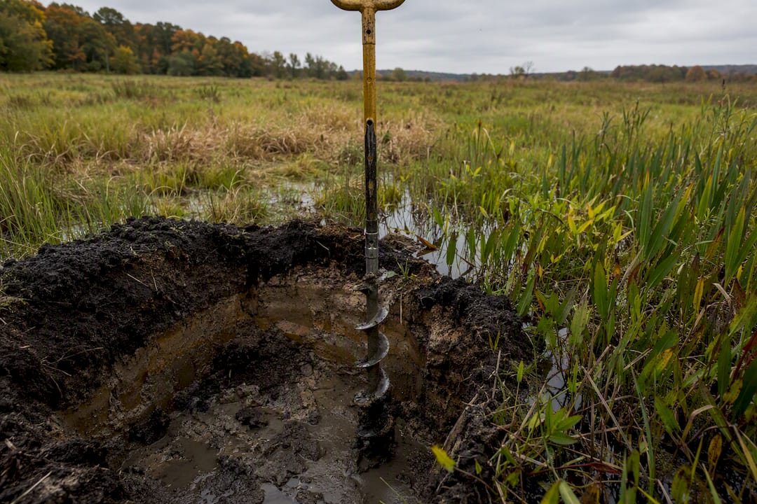
At each sample plot along a transect, the field crew records vegetation, soil, and hydrology data on a standardized form. If a plot meets all three criteria, it's flagged as wetland. If it fails even one, it's upland. The actual boundary gets placed between the last wetland plot and the first upland plot, adjusted using visual cues like changes in plant community, soil color, or topography that the crew observes while walking the transition zone.
This is where experience matters more than most landowners expect. Two consultants can sample the same property and draw slightly different lines, particularly in transition zones where vegetation is mixed or hydrology signs are subtle. That's part of why the 1987 manual allows for professional judgment within a structured framework rather than a rigid formula.
Once the field boundary is set, it gets converted to GPS coordinates and drawn as a polygon in GIS software. That digital boundary is what eventually gets submitted for agency review, so accuracy at this stage carries forward into every later permitting decision. A boundary based on a handheld GPS unit with several feet of error reads differently to a reviewing agency than one tied to survey-grade coordinates, which is why higher-stakes projects often pay for the upgrade.
Tips for Ensuring Compliance to Avoid Regulatory Penalties
Unpermitted fill or grading in a jurisdictional wetland can trigger Clean Water Act enforcement, and the cleanup and fines involved almost always cost more than the delineation would have.
The most reliable safeguard is sequencing: get the delineation done before any site disturbance, not after. Grading, clearing, or even stockpiling material in a wetland before it's mapped and permitted is one of the most common ways developers end up in enforcement conversations they didn't see coming.
Keep documentation organized and available, including the field data sheets, the consultant's narrative report, and any correspondence with the agency. If a regulator ever questions the boundary, having the original data on hand, rather than just the final map, makes the difference between a quick resolution and a drawn-out dispute.
Don't treat a delineation as a one-time event on a long-hold property. Wetland hydrology and vegetation can shift over years due to drainage changes, upstream development, or even drought cycles, and an outdated delineation may not hold up if the agency revisits it. Confirm with your consultant whether your existing delineation is still considered current before you build on it.
Finally, coordinate early with your local USACE district or state agency rather than waiting until permit submittal. Because agency interpretations of jurisdictional waters can shift and vary by district, a quick pre-application conversation can surface issues while they're still cheap to fix.
Common Challenges During the Delineation Process and How to Address Them
Seasonal timing trips up more projects than almost anything else. Vegetation indicators are hardest to read outside the growing season, and if fieldwork happens during an unusual drought or right after a flood, hydrology signs can be misleading. Experienced consultants document antecedent precipitation conditions and, when conditions look abnormal, return for a confirmation visit rather than relying on a single site walk.
Disturbed or altered sites present another recurring problem. Properties that have been mowed, grazed, or previously graded often lack the "textbook" vegetation communities the manual describes, forcing the consultant to rely more heavily on soil and hydrology evidence, or shift to the comprehensive procedure.
Access issues, dense understory, standing water, or restricted entry, slow down transect work and can stretch a one-day field visit into several. Budgeting extra time for difficult terrain up front avoids surprise change orders later.
Disagreement with the agency's own review is the challenge that causes the most schedule pain. A consultant's routine delineation is a professional opinion; the agency can still reach a different conclusion during JD review. The best defense is thorough documentation at every sample point, not just the final boundary, since a well-documented data form gives you something concrete to point to if a reviewer pushes back.
Boundary disputes with neighbors or prior owners can also surface once a wetland limit crosses a property line. Survey-grade coordinates, tied to a licensed surveyor's stamp, resolve most of these disputes faster than a handheld GPS reading ever will.
Overview of Relevant Regulations and Permitting Requirements
Section 404 of the Clean Water Act is the anchor regulation, requiring a permit for discharging fill material into jurisdictional waters, including wetlands. USACE administers that permit program, and a delineation is the technical foundation the agency uses to decide whether a given area falls under its authority at all.
Beyond the federal layer, most states run their own wetland regulatory programs that can be more restrictive than the federal standard, covering wetlands that don't meet federal jurisdiction but still qualify under state law. Some local governments add a third layer through zoning overlays or conservation ordinances tied to environmentally sensitive areas.
This layering means a single property can trigger federal, state, and local review simultaneously, each with its own submittal requirements and, sometimes, its own delineation standard. A consultant who only knows the federal manual and hasn't worked with your specific state agency can miss requirements that only show up in the regional supplement or state guidance, an issue state resource pages are specifically designed to help consultants and landowners avoid.
Because WOTUS interpretations shift over time and vary by USACE district, what qualified as jurisdictional a few years ago on a similar site nearby may not apply the same way today. That's a strong argument for confirming current guidance with your local district rather than relying on a neighbor's old permit history as a benchmark.
Examples of Field Data Collection Techniques and Tools Used
Field crews rely on a mix of low-tech and high-tech tools, and the balance between them often signals how rigorous the delineation actually is.
Handheld GPS units and, on higher-budget projects, survey-grade RTK GPS equipment capture the coordinates of every sample plot and the final boundary line. A soil auger or sharpshooter shovel opens pits typically 12 to 20 inches deep so the crew can examine soil color, texture, and redox features against the NRCS field indicator list.
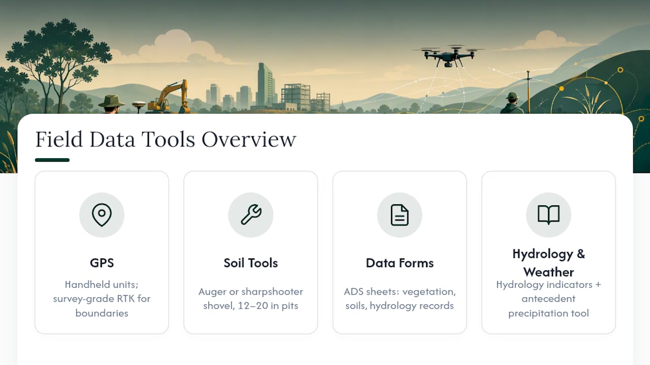
Standardized data forms, often the Corps' own ADS data sheets, capture vegetation percent cover by stratum, dominant species, soil observations by depth, and hydrology indicators like water marks, drainage patterns, or algal mats. Some districts also make an Antecedent Precipitation Tool available so crews can document whether rainfall conditions leading up to the site visit were normal, unusually wet, or unusually dry, which matters for interpreting hydrology evidence fairly.
Vegetation identification still leans heavily on trained botanical knowledge paired with regional plant indicator status lists, since software can't reliably substitute for a trained eye distinguishing similar-looking wetland and upland species in the field. Aerial imagery and historic soil survey maps, reviewed before the site visit, help crews predict where to focus transects instead of walking the entire parcel blind.
Why Treating Delineation as a Scheduling Tool Beats Treating It as a Compliance Checkbox
Most guidance on this topic frames delineation as a regulatory hoop: something you do because a permit requires it. That framing gets the sequencing backward. The developers who avoid costly redesigns are the ones who order a delineation before they've committed to a site plan, not after an engineer has already drawn roads and pads around assumptions that turn out to be wrong.
The conventional advice to "just hire an environmental consultant when you're ready to permit" ignores how much a wetland boundary can reshape buildable acreage, and by the time permitting starts, the layout is usually locked. That's an expensive moment to discover a wetland eats into your densest lot.
If you take one thing from this, it's that a delineation is cheapest and most useful early, as a feasibility input, not a submittal requirement. Order it before you finalize a purchase price, before you draw a concept plan, and definitely before any grading equipment shows up on-site.
— Jeremy Wenger
Let Urban Planning Pros Handle Your Wetland Delineation and Feasibility Work
Hiring separate vendors for delineation, mapping, and feasibility analysis usually means three different timelines that don't talk to each other, and a boundary finding that shows up after your site plan is already drawn. Urban Planning Pros runs Phase 2 wetland delineations alongside feasibility studies and GPS/GIS mapping, so the boundary data feeds directly into your site layout instead of arriving after the fact.

For projects that need survey-grade coordination alongside the delineation, Urban Planning Pros also works with partners like Bazini Engineering to close the gap between field data and construction-ready plans. If you're weighing a purchase, planning a subdivision, or staring down a permit deadline, request a scoped feasibility study before your site plan gets locked in. Reach out to Urban Planning Pros to define the scope and timeline for your property.
Sources
- Corps of Engineers Wetlands Delineation Manual (1987) — electronic version
- Field Indicators of Hydric Soils in the United States, Version 9.3 (NRCS)
- Wetland delineation resources — Washington State Department of Ecology
- Freshwater wetland jurisdictional determination — NYSDEC